|
With my research I aim at answering fundamental questions in ecology and to provide methodological progress that informs nature protection about the impact of global change on biodiversity and ecosystems. Overall, my research has four main components: (i) empirical studies to gain fundamental insight on the factors and processes that determine ecological patterns and responses across time and space, (ii) methodological improvements of models of species’ past and future ranges, (iii) facilitating cross scale integration by applying drone-, air-, and satellite-borne remote sensing to monitor, understand, and predict vegetation and biodiversity dynamics, and (iv) investigating human-nature interactions.
|
|
Signe Normand |
Current Research · Publications · Bio |
 |
I am a macro- and vegetation ecologist dedicated to understand vegetation dynamics across space and time |
Professor
Director of SustainScapes
Aarhus University
Ny Munkegade 116, Building 1540 DK-8000 Aarhus C, Denmark
|
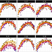 |
80. ‘LandsatTS’: an R package to facilitate retrieval, cleaning, cross‐calibration, and phenological modeling of Landsat time series data Berner LT, Assmann JJ, Normand S & Goetz SJ |
Read Abstract |
||
|
The Landsat satellites provide decades of near-global surface reflectance measurements that are increasingly used to assess interannual changes in terrestrial ecosystem function. These assessments often rely on spectral indices related to vegetation greenness and productivity (e.g. Normalized Difference Vegetation Index, NDVI). Nevertheless, multiple factors impede multi-decadal assessments of spectral indices using Landsat satellite data, including ease of data access and cleaning, as well as lingering issues with cross-sensor calibration and challenges with irregular timing of cloud-free acquisitions. To help address these problems, we developed the ‘LandsatTS' package for R. This software package facilitates sample-based time series analysis of surface reflectance and spectral indices derived from Landsat sensors. The package includes functions that enable the extraction of the full Landsat 5, 7, and 8 records from Collection 2 for point sample locations or small study regions using Google Earth Engine accessed directly from R. Moreover, the package includes functions for 1) rigorous data cleaning, 2) cross-sensor calibration, 3) phenological modeling, and 4) time series analysis. For an example application, we show how ‘LandsatTS' can be used to assess changes in annual maximum vegetation greenness from 2000 to 2022 across the Noatak National Preserve in northern Alaska, USA. Overall, this software provides a suite of functions to enable broader use of Landsat satellite data for assessing and monitoring terrestrial ecosystem function during recent decades across local to global geographic extents.
Keywords: cross-sensor calibration • Google Earth Engine • greening and browning • Landsat • NDVI • spectral index |
||||
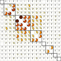 |
79. Vegetation structure from LiDAR explains the local richness of birds across Denmark Davison CW, Assmann JJ, Normand S, Rahbek C & Morueta-Holme N |
Read Abstract |
||
|
1. Classic ecological research into the determinants of biodiversity patterns emphasised the important role of three-dimensional (3D) vegetation heterogeneity. Yet, measuring vegetation structure across large areas has historically been difficult. A growing focus on large-scale research questions has caused local vegetation heterogeneity to be overlooked compared with more readily accessible habitat metrics from, for example, land cover maps.
|
||||
 |
78. Plant traits poorly predict winner and loser shrub species in a warming tundra biome Criado MG, Myers-Smith IH, Bjorkman AD, Normand S et al. |
Read Abstract |
||
|
Climate change is leading to species redistributions. In the tundra biome, shrubs are generally expanding, but not all tundra shrub species will benefit from warming. Winner and loser species, and the characteristics that may determine success or failure, have not yet been fully identified. Here, we investigate whether past abundance changes, current range sizes and projected range shifts derived from species distribution models are related to plant trait values and intraspecific trait variation. We combined 17,921 trait records with observed past and modelled future distributions from 62 tundra shrub species across three continents. We found that species with greater variation in seed mass and specific leaf area had larger projected range shifts, and projected winner species had greater seed mass values. However, trait values and variation were not consistently related to current and projected ranges, nor to past abundance change. Overall, our findings indicate that abundance change and range shifts will not lead to directional modifications in shrub trait composition, since winner and loser species share relatively similar trait spaces.
Keywords: Biodiversity • Biogeography • Climate-change ecology • Macroecology • Tundra • Plant Traits |
||||
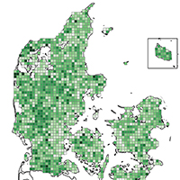 |
77. The influence of landscape characteristics on breeding bird dark diversity Andersen AH, Clausen KK, Normand S, Vikstrøm T & Moeslund JE |
Read Abstract |
||
|
The exploration of factors and processes affecting biodiversity loss is central to nature management and wildlife conservation, but only recently has knowledge about the absence of species been recognized as a valuable asset to understand the current biodiversity crisis. In this paper, we explore the dark diversity (species that belong to a site-specific species pool but that are not locally present) of breeding birds in Denmark assessed through species co-occurrence patterns. We apply a nation-wide atlas survey of breeding birds (with a 5 × 5 km resolution), to investigate how landscape characteristics may influence avian diversity, and whether threatened and near threatened species are more likely to occur in dark diversity than least concern (LC) species. On average, the dark diversity constituted 41% of all species belonging to the site-specific species pools and threatened and near-threatened species had a higher probability of belonging to the dark diversity than least concern species. Habitat heterogeneity was negatively related to dark diversity and the proportional cover of intensive agriculture positively related, implying that homogeneous landscapes dominated by agricultural interests led to more absent avian species. Finally, we found significant effects of human disturbance and distance to the coast, indicating that more breeding bird species were missing when human disturbance was high and in near-coastal areas. Our study provides the first attempt to investigate dark diversity among birds and highlights how important landscape characteristics may shape breeding bird diversity and reveal areas of considerable species impoverishment.
|
||||
 |
76. CHELSA-TraCE21k – high-resolution (1 km) downscaled transient temperature and precipitation data since the Last Glacial Maximum Karger DN, Nobis MP, Normand S, Graham CH & Zimmermann NE |
Read Abstract |
||
|
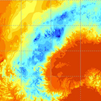
High-resolution, downscaled climate model data are used in a wide variety of applications across environmental sciences. Here we introduce a new, high-resolution dataset, CHELSA-TraCE21k. It is obtained by downscaling TraCE-21k data, using the “Climatologies at high resolution for the earth's land surface areas” (CHELSA) V1.2 algorithm with the objective to create global monthly climatologies for temperature and precipitation at 30 arcsec spatial resolution in 100-year time steps for the last 21 000 years. Paleo-orography at high spatial resolution and for each time step is created by combining high-resolution information on glacial cover from current and Last Glacial Maximum (LGM) glacier databases and interpolations using data from a global model of glacial isostasy (ICE-6G_C) and a coupling to mean annual temperatures from TraCE21k (Transient Climate Evolution of the last 21 000 years) based on the Community Climate System Model version 3 (CCSM3). Based on the reconstructed paleo-orography, mean annual temperature and precipitation were downscaled using the CHELSA V1.2 algorithm. The data were validated by comparisons with the glacial extent of the Laurentide ice sheet based on expert delineations, proxy data from Greenland ice cores, historical climate data from meteorological stations, and a dynamic simulation of species distributions throughout the Holocene. Validations show that the CHELSA-TraCE21k V1.0 dataset reasonably represents the distribution of temperature and precipitation through time at an unprecedented 1 km spatial resolution, and simulations based on the data are capable of detecting known LGM refugia of species.
|
||||
 |
75. Grazing by semi-feral cattle and horses supports plant species richness and uniqueness in grasslands Bonavent C, Olsen K, Ejrnæs R, Fløjgaard C, Hansen MDD, Normand S, Svenning JC & Bruun HH |
Read Abstract |
||
|
Question
|
||||
 |
74. The spectral species concept in living color Rocchini D, Santos MJ, Ustin SL, Féret JB, Asner GP, Beierkuhnlein C et al. |
Read Abstract |
||
|
Biodiversity monitoring is an almost inconceivable challenge at the scale of the entire Earth. The current (and soon to be flown) generation of spaceborne and airborne optical sensors (i.e., imaging spectrometers) can collect detailed information at unprecedented spatial, temporal, and spectral resolutions. These new data streams are preceded by a revolution in modeling and analytics that can utilize the richness of these datasets to measure a wide range of plant traits, community composition, and ecosystem functions. At the heart of this framework for monitoring plant biodiversity is the idea of remotely identifying species by making use of the ‘spectral species’ concept. In theory, the spectral species concept can be defined as a species characterized by a unique spectral signature and thus remotely detectable within pixel units of a spectral image. In reality, depending on spatial resolution, pixels may contain several species which renders species-specific assignment of spectral information more challenging. The aim of this paper is to review the spectral species concept and relate it to underlying ecological principles, while also discussing the complexities, challenges and opportunities to apply this concept given current and future scientific advances in remote sensing.
Plain Language Summary: Biodiversity monitoring based on field data is almost inconceivable at the scale of the entire Earth. Over the past decades, remote sensing has opened possibilities for Earth observation from air and space, allowing us to monitor ecological change, primarily expressed by changes in vegetation cover, distribution, and functioning, which can be subsequently linked to drivers of change in space and time, from local to global scale. Recently, the spectral species concept—an algorithm that clusterizes pixels from spectral images having a similar spectral signal (referred to as ‘spectral species’)—has brought attention. The aim of this paper is to review the ecological functioning principles of the spectral species concept and to refine its definition by a better linkage with field observations of plant species distribution data (i.e., presence-absence data) available from vegetation surveys.
Keywords: remote sensing • earth observation • monitoring ecological change • biodiversity • spectral species concept • diversity metrics |
||||
 |
73. Cross-scale regulation of seasonal microclimate by vegetation and snow in the Arctic tundra von Oppen J, Assmann JJ, Bjorkman AD, Treier UA, Elberling B, Nabe-Nielsen J & Normand S |
Read Abstract |
||
|
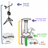
Climate warming is inducing widespread vegetation changes in Arctic tundra ecosystems, with the potential to alter carbon and nutrient dynamics between vegetation and soils. Yet, we lack a detailed understanding of how variation in vegetation and topography influences fine-scale temperatures (“microclimate”) that mediate these dynamics, and at what resolution vegetation needs to be sampled to capture these effects. We monitored microclimate at 90 plots across a tundra landscape in western Greenland. Our stratified random study design covered gradients of topography and vegetation, while nested plots (0.8–100 m2) enabled comparison across different sampling resolutions. We used Bayesian mixed-effect models to quantify the direct influence of plot-level topography, moisture and vegetation on soil, near-surface and canopy-level temperatures (−6, 2, and 15 cm). During the growing season, colder soils were predicted by shrub cover (−0.24°C per 10% increase), bryophyte cover (−0.35°C per 10% increase), and vegetation height (−0.17°C per 1 cm increase). The same three factors also predicted the magnitude of differences between soil and above-ground temperatures, indicating warmer soils at low cover/height, but colder soils under closed/taller canopies. These findings were consistent across plot sizes, suggesting that spatial predictions of microclimate may be possible at the operational scales of satellite products. During winter, snow cover (+0.75°C per 10 snow-covered days) was the key predictor of soil microclimate. Topography and moisture explained little variation in the measured temperatures. Our results not only underline the close connection of vegetation and snow with microclimate in the Arctic tundra but also point to the need for more studies disentangling their complex interplay across tundra environments and seasons. Future shifts in vegetation cover and height will likely mediate the impact of atmospheric warming on the tundra soil environment, with potential implications for below-ground organisms and ecosystem functioning.
|
||||
 |
72. Circum-Arctic distribution of chemical anti-herbivore compounds suggests biome-wide trade-off in defence strategies in Arctic shrubs Lindén E, te Beest M, Aubreu I, Moritz T, Sundqvist KM et al. |
Read Abstract |
||
|
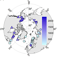
Spatial variation in plant chemical defence towards herbivores can help us understand variation in herbivore top–down control of shrubs in the Arctic and possibly also shrub responses to global warming. Less defended, non-resinous shrubs could be more influenced by herbivores than more defended, resinous shrubs. However, sparse field measurements limit our current understanding of how much of the circum-Arctic variation in defence compounds is explained by taxa or defence functional groups (resinous/non-resinous). We measured circum-Arctic chemical defence and leaf digestibility in resinous (Betula glandulosa, B. nana ssp. exilis) and non-resinous (B. nana ssp. nana, B. pumila) shrub birches to see how they vary among and within taxa and functional groups. Using liquid chromatography–mass spectrometry (LC–MS) metabolomic analyses and in vitro leaf digestibility via incubation in cattle rumen fluid, we analysed defence composition and leaf digestibility in 128 samples from 44 tundra locations.
Keywords: Arctic • Betula • birch • herbivory • metabolomics • plant chemical defence • shrubs |
||||
 |
71. Improving ecological insights from dendroecological studies of Arctic shrub dynamics: Research gaps and potential solutions Power CC, Assmann JJ, Prendin AL, Treier UA, Kerby JT & Normand S |
Read Abstract |
||
|
Rapid climate change has been driving changes in Arctic vegetation in recent decades, with increased shrub dominance in many tundra ecosystems. Dendroecological observations of tundra shrubs can provide insight into current and past growth and recruitment patterns, both key components for understanding and predicting ongoing and future Arctic shrub dynamics. However, generalizing these dynamics is challenging as they are highly scale-dependent and vary among sites, species, and individuals. Here, we provide a perspective on how some of these challenges can be overcome. Based on a targeted literature search of dendrochronological studies from 2005 to 2022, we highlight five research gaps that currently limit dendro-based studies from revealing cross-scale ecological insight into shrub dynamics across the Arctic biome. We further discuss the related research priorities, suggesting that future studies could consider: 1) increasing focus on intra- and interspecific variation, 2) including demographic responses other than radial growth, 3) incorporating drivers, in addition to warming, at different spatial and temporal scales, 4) implementing systematic and unbiased sampling approaches, and 5) investigating the cellular mechanisms behind the observed responses. Focusing on these aspects in dendroecological studies could improve the value of the field for addressing cross-scale and plant community-framed ecological questions. We outline how this could be facilitated through the integration of community-based dendroecology and dendroanatomy with remote sensing approaches. Integrating new technologies and a more multidisciplinary approach in dendroecological research could provide key opportunities to close important knowledge gaps in our understanding of scale-dependencies, as well as intra- and inter-specific variation, in vegetation community dynamics across the Arctic tundra.
Keywords: Demographic responses • Shrub ring-width • Spatial-temporal scales • Earth observations • Sampling approach • Community-based dendroecological sampling |
||||
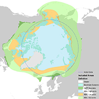 |
70. What evidence exists for temporal variability in Arctic terrestrial and freshwater biodiversity throughout the Holocene? A systematic map protocol Martin AC, Assmann JJ, Bradshaw RHW, Kuoppamaa M, Kuosmanen NI, Normand S, Speed JDM & Macias-Fauria M |
Read Abstract |
||
|
Background: The Arctic tundra is subject to the greatest climate change-induced temperature rises of any biome. Both terrestrial and freshwater biota are responding to recent climate warming through variability in their distribution, abundance, and richness. However, uncertainty arises within models of future change when considering processes that operate over centennial timescales. A systematic evidence synthesis of centennial-scale variability in biodiversity does not currently exist for the Arctic biome. Here, we sought to address the primary research question: what evidence exists for temporal variability in Arctic terrestrial and freshwater biodiversity throughout the Holocene (11,650 years before present (yBP)—0yBP)?
|
||||
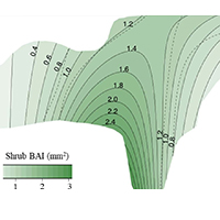 |
69. Growth rings show limited evidence for ungulates' potential to suppress shrubs across the Arctic Vuorinen KEM, Austrheim G, Tremblay JP et al. |
Read Abstract |
||
|
Global warming has pronounced effects on tundra vegetation, and rising mean temperatures increase plant growth potential across the Arctic biome. Herbivores may counteract the warming impacts by reducing plant growth, but the strength of this effect may depend on prevailing regional climatic conditions. To study how ungulates interact with temperature to influence growth of tundra shrubs across the Arctic tundra biome, we assembled dendroecological data from 20 sites, comprising 1153 individual shrubs and 223 63 annual growth rings. Evidence for ungulates suppressing shrub radial growth was only observed at intermediate summer temperatures (6.5°C – 9°C), and even at these temperatures the effect was not strong. Multiple factors, including forage preferences and landscape use by the ungulates, and favourable climatic conditions enabling effective compensatory growth of shrubs, may weaken the effects of ungulates on shrubs, possibly explaining the weakness of observed ungulate effects. Earlier local studies have shown that ungulates may counteract the impacts of warming on tundra shrub growth, but we demonstrate that ungulates' potential to suppress shrub radial growth is not always evident, and may be limited to certain climatic conditions.
Keywords: Arctic • browsing • climate change • dendroecology • herbivory • shrub • tundra |
||||
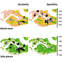 |
68. High resolution species distribution and abundance models cannot predict separate shrub datasets in adjacent Arctic fjords Chardon NI, Nabe-Nielsen J, Assmann JJ, Jacobsen IBD, Guéguen M, Normand S & Wipf S |
Read Abstract |
||
|
Aim
Keywords: Arctic tundra • field survey methods • model validation • shrubs • spatial scale • species abundance model • species distribution model
|
||||
 |
67. Influences of summer warming and nutrient availability on Salix glauca L. growth in Greenland along an ice to sea gradient Prendin AL, Normand S, Carrer M, Pedersen NB, Matthiesen H, Westergaard-Nielsen A, Elberling B, Treier UA & Hollesen J |
Read Abstract |
||
|
The combined effects of climate change and nutrient availability on Arctic vegetation growth are poorly understood. Archaeological sites in the Arctic could represent unique nutrient hotspots for studying the long-term effect of nutrient enrichment. In this study, we analysed a time-series of ring widths of Salix glauca L. collected at nine archaeological sites and in their natural surroundings along a climate gradient in the Nuuk fjord region, Southwest Greenland, stretching from the edge of the Greenlandic Ice Sheet in the east to the open sea in the west. We assessed the temperature-growth relationship for the last four decades distinguishing between soils with past anthropogenic nutrient enrichment (PANE) and without (controls). Along the East–West gradient, the inner fjord sites showed a stronger temperature signal compared to the outermost ones. Individuals growing in PANE soils had wider ring widths than individuals growing in the control soils and a stronger climate-growth relation, especially in the inner fjord sites. Thereby, the individuals growing on the archaeological sites seem to have benefited more from the climate warming in recent decades. Our results suggest that higher nutrient availability due to past human activities plays a role in Arctic vegetation growth and should be considered when assessing both the future impact of plants on archaeological sites and the general greening in landscapes with contrasting nutrient availability. Keywords: Arctic • Salix glauca • grayleaf willow • human perturbation • nutrient availability • climate‑growth relationship • vegetation • Greenland • shrub‑ring chronologies |
||||
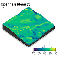 |
66. EcoDes-DK15: High-resolution ecological descriptors of vegetation and terrain derived from Denmark's national airborne laser scanning data set Assmann JJ, Moeslund JE, Treier UA & Normand S |
Read Abstract |
||
|
Biodiversity studies could strongly benefit from three-dimensional data on ecosystem structure derived from contemporary remote sensing technologies, such as Light Detection and Ranging (LiDAR). Despite the increasing availability of such data at regional and national scales, the average ecologist has been limited in accessing them due to high requirements on computing power and remote-sensing knowledge. We processed Denmark's publicly available national Airborne Laser Scanning (ALS) data set acquired in 2014/15 together with the accompanying elevation model to compute 70 rasterized descriptors of interest for ecological studies. With a grain size of 10 m, these data products provide a snapshot of high-resolution measures including vegetation height, structure and density, as well as topographic descriptors including elevation, aspect, slope and wetness across more than forty thousand square kilometres covering almost all of Denmark's terrestrial surface. The resulting data set is comparatively small (~ 87 GB, compressed 16.4 GB) and the raster data can be readily integrated into analytical workflows in software familiar to many ecologists (GIS software, R, Python). Source code and documentation for the processing workflow are openly available via a code repository, allowing for transfer to other ALS data sets, as well as modification or re-calculation of future instances of Denmark’s national ALS data set. We hope that our high-resolution ecological vegetation and terrain descriptors (EcoDes-DK15) will serve as an inspiration for the publication of further such data sets covering other countries and regions and that our rasterized data set will provide a baseline of the ecosystem structure for current and future studies of biodiversity, within Denmark and beyond. |
||||
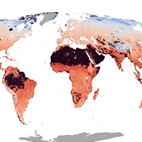 |
65. Global maps of soil temperature Lembrechts JJ, van den Hoogen J et al. |
Read Abstract |
||
|
Research in global change ecology relies heavily on global climatic grids derived from estimates of air temperature in open areas at around 2 m above the ground. These climatic grids do not reflect conditions below vegetation canopies and near the ground surface, where critical ecosystem functions occur and most terrestrial species reside. Here, we provide global maps of soil temperature and bioclimatic variables at a 1-km² resolution for 0–5 and 5–15 cm soil depth. These maps were created by calculating the difference (i.e., offset) between in-situ soil temperature measurements, based on time series from over 1200 1-km² pixels (summarized from 8500 unique temperature sensors) across all the world’s major terrestrial biomes, and coarse-grained air temperature estimates from ERA5-Land (an atmospheric reanalysis by the European Centre for Medium-Range Weather Forecasts). We show that mean annual soil temperature differs markedly from the corresponding gridded air temperature, by up to 10°C (mean = 3.0 ± 2.1°C), with substantial variation across biomes and seasons. Over the year, soils in cold and/or dry biomes are substantially warmer (+3.6 ± 2.3°C) than gridded air temperature, whereas soils in warm and humid environments are on average slightly cooler (-0.7 ± 2.3°C). The observed substantial and biome-specific offsets emphasize that the projected impacts of climate and climate change on near-surface biodiversity and ecosystem functioning are inaccurately assessed when air rather than soil temperature is used, especially in cold environments. The global soil-related bioclimatic variables provided here are an important step forward for any application in ecology and related disciplines. Nevertheless, we highlight the need to fill remaining geographic gaps by collecting more in-situ measurements of microclimate conditions to further enhance the spatiotemporal resolution of global soil temperature products for ecological applications.
Keywords: bioclimatic variables • global maps • microclimate • near-surface temperatures • soil-dwelling organisms • soil temperature • temperature offset • weather stations |
||||
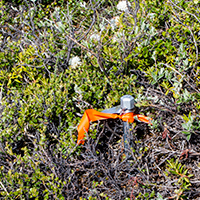 |
64. Annual air temperature variability and biotic interactions explain tundra shrub species abundance von Oppen J, Normand S, Bjorkman AD, Blach-Overgaard A, Assmann JJ, Forchhammer M, Guéguen M & Nabe-Nielsen J
|
Read Abstract |
||
|
Questions |
||||
 |
63. Chemical signature of Eurois occulta L. outbreaks in the xylem cell wall of Salix glauca L. in Greenland Prendin AL, Carrer M, Pedersen NB, Normand S, Hollesen J, Treier UA, Pividori M & Thygesen LG |
Read Abstract |
||
|
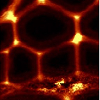
Insect defoliations are a major natural disturbance in high-latitude ecosystems and are expected to increase in frequency and severity due to current climatic change. Defoliations cause severe reductions in biomass and carbon investments that affect the functioning and productivity of tundra ecosystems. Here we combined dendro-anatomical analysis with chemical imaging to investigate the direct and lagged effects of insect outbreaks on carbon investment. We analysed the content of lignin vs. holocellulose, i.e. unspecified carbohydrates in xylem samples of Salix glauca L. collected at Iffiartarfik, Nuuk fjord, Greenland, featuring two outbreak events of the moth Eurois occulta L. Cross sections of the growth rings corresponding to both outbreaks ±3 years were analysed using confocal Raman imaging to identify possible chemical signatures related to insect defoliation on fibres, vessels, and ray parenchyma cells and to get insight into species-specific defence responses. Outbreak years with narrower rings and thinner fibre cell walls are accompanied by a change in the content of cell-wall polymers but not their underlying chemistry. Indeed, during the outbreaks the ratio between lignin and carbohydrates significantly increased in fibre but not vessel cell walls due to an increase in lignin content coupled with a reduced content of carbohydrates. Parenchyma cell walls and cell corners did not show any significant changes in the cell-wall biopolymer content. The selective adjustment of the cell-wall composition of fibres but not vessels under stressful conditions could be related to the plants priority to maintain an efficient hydraulic system rather than mechanical support. However, the higher lignin content of fibre cell walls formed during the outbreak events could increase mechanical stiffness to the thin walls by optimizing the available resources. Chemical analysis of xylem traits with Raman imaging is a promising approach to highlight hidden effects of defoliation otherwise overlooked with classical dendroecological methods.
Keywords: chemical imaging • Raman micro-spectroscopy • insect outbreaks • lignocellulose • wood anatomy • Greenland |
||||
 |
62. Detecting shrub encroachment in seminatural grasslands using UAS LiDAR Madsen B, Treier UA, Zlinszky A, Lucieer A & Normand S |
Read Abstract |
||
|
1. Shrub encroachment in seminatural grasslands threatens local biodiversity unless management is applied to reduce shrub density. Dense vegetation of Cytisus scoparius homogenizes the landscape negatively affecting local plant diversity. Detecting structural change (e.g., biomass) is essential for assessing negative impacts of encroachment. Hence, exploring new monitoring tools to achieve this task is important for effectively capturing change and evaluating management activities. 2. This study combines traditional field‐based measurements with novel Light Detection and Ranging (LiDAR) observations from an Unmanned Aircraft System (UAS). We investigate the accuracy of mapping C. scoparius in three dimensions (3D) and of structural change metrics (i.e., biomass) derived from ultrahigh‐density point cloud data (>1,000 pts/m2). Presence–absence of 12 shrub or tree genera was recorded across a 6.7 ha seminatural grassland area in Denmark. Furthermore, 10 individuals of C. scoparius were harvested for biomass measurements. With a UAS LiDAR system, we collected ultrahigh‐density spatial data across the area in October 2017 (leaf‐on) and April 2018 (leaf‐off). We utilized a 3D point‐based classification to distinguish shrub genera based on their structural appearance (i.e., density, light penetration, and surface roughness). 3. From the identified C. scoparius individuals, we related different volume metrics (mean, max, and range) to measured biomass and quantified spatial variation in biomass change from 2017 to 2018. We obtained overall classification accuracies above 86% from point clouds of both seasons. Maximum volume explained 77.4% of the variation in biomass. 4. The spatial patterns revealed landscape‐scale variation in biomass change between autumn 2017 and spring 2018, with a notable decrease in some areas. Further studies are needed to disentangle the causes of the observed decrease, for example, recent winter grazing and/or frost events. 5. Synthesis and applications: We present a workflow for processing ultrahigh‐density spatial data obtained from a UAS LiDAR system to detect change in C. scoparius. We demonstrate that UAS LiDAR is a promising tool to map and monitor grassland shrub dynamics at the landscape scale with the accuracy needed for effective nature management. It is a new tool for standardized and nonbiased evaluation of management activities initiated to prevent shrub encroachment.
Keywords: biomass • grassland dynamics • remote sensing • scotch broom • shrub encroachment • UAS LiDAR |
||||
 |
61. Global plant trait relationships extend to the climatic extremes of the tundra biome Thomas HJD, Bjorkman AD, Myers-Smith IH, Elmendorf SC, Kattge J, Diaz S, Vellend M et al. |
Read Abstract |
||
|
The majority of variation in six traits critical to the growth, survival and reproduction of plant species is thought to be organised along just two dimensions, corresponding to strategies of plant size and resource acquisition. However, it is unknown whether global plant trait relationships extend to climatic extremes, and if these interspecific relationships are confounded by trait variation within species. We test whether trait relationships extend to the cold extremes of life on Earth using the largest database of tundra plant traits yet compiled. We show that tundra plants demonstrate remarkably similar resource economic traits, but not size traits, compared to global distributions, and exhibit the same two dimensions of trait variation. Three quarters of trait variation occurs among species, mirroring global estimates of interspecific trait variation. Plant trait relationships are thus generalizable to the edge of global trait-space, informing prediction of plant community change in a warming world.
Keywords: Tundra biome • climate • plant traits • TRY • alpine • arctic • Tundra Trait Team (TTT) |
||||
 |
60. Complexity revealed in the greening of the Arctic Myers-Smith IH, Kerby JT, Phoenix GK, Bjerke JW, Epstein HE, Assmann JJ, John C et al. |
Read Abstract |
||
|
As the Arctic warms, vegetation is responding, and satellite measures indicate widespread greening at high latitudes. This ‘greening of the Arctic’ is among the world’s most important large-scale ecological responses to global climate change. However, a consensus is emerging that the underlying causes and future dynamics of so-called Arctic greening and browning trends are more complex, variable and inherently scale-dependent than previously thought. Here we summarize the complexities of observing and interpreting high-latitude greening to identify priorities for future research. Incorporating satellite and proximal remote sensing with in-situ data, while accounting for uncertainties and scale issues, will advance the study of past, present and future Arctic vegetation change.
Keywords: Tundra • climate • Arctic greening and browning • NDVI • Satellite • Landsat • MODIS • high-latitude ecosystems • Climate Change |
||||
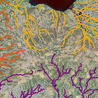 |
59. Estimating meltwater retention and associated nitrate redistribution during snowmelt in an Arctic tundra landscape Westergaard-Nielsen A, Balstrøm T, Treier UA, Normand S & Elberling B |
Read Abstract |
||
|
Nitrogen availability in Arctic ecosystems is a key driver for biological activity, including plant, growth and thereby directly linked to the greening of the Arctic. Here, we model the redistribution of meltwater following spring snowmelt as well as the accumulation of meltwater and dissolved nitrate at landscape scale. By combining snow mapping with unmanned aerial systems, snow chemistry, and hydrological modelling, we argue that the majority of nitrate in the snowpack is flushed out of the landscape due to the limited storage capacity of meltwater in the early growing season frozen soil. We illustrate how landscape micro-topography is a crucial parameter to quantify storage capacity of meltwater at landscape scale and thereby the associated pool of soluble compounds such as nitrate. This pool will be available for plants and may be important for plant diversity and growth rates in the wettest part of the landscape. This study illustrates that the evenly distributed nitrate input during the Arctic winter may be redistributed during the initial snowmelt and lead to marked differences in biologically available nitrate at the onset of the growing season, but also that the majority of deposited nitrate in snow is lost from the terrestrial to the aquatic environment during snowmelt.
|
||||
 |
58. Recent global changes have decoupled species richness from specialization patterns in North American birds Mimet A, Buitenwerf R, Sandel B, Svenning JC & Normand S |
Read Abstract |
||
|
Aim Theory suggests that increasing productivity and climate stability towards the tropics favours specialization, thus contributing to the latitudinal richness gradient. A positive relationship between species richness and specialization should therefore emerge as a fundamental biogeographical pattern. However, land-use and climate changes disproportionally increase the local extirpation risk for specialists, potentially weakening the relationship between richness and specialization. Here, we quantify empirically the richness–specialization prediction and test how 50 years of climate and land-use change has affected the richness–specialization relationship. Location USA. Time period 1966–2015. Major taxa studied Birds. Methods We used the North American Breeding Bird Survey to quantify bird community richness and specialization to habitat and climate. We (a) quantify temporal change in the slope of the richness–specialization relationship, using a generalized mixed model; (b) assess how this change translates spatially, using generalized additive models; and (c) attribute spatio-temporal change in the richness–specialization relationship to land use, climate and topographic drivers. Results We found evidence for a positive but weak richness–specialization relationship in bird communities that greatly weakened over time. Given that specialization was not the main driver of richness, this relationship did not translate spatially into a linear spatial covariation between richness and specialization. Instead, the spatial covariation in richness and specialization followed a unimodal pattern, the peak of which shifted towards less specialized communities over time. These temporal changes were associated with precipitation change, decreasing temperature stability and land use. Main conclusions Recent climate and land-use changes have induced two contrasting types of community responses. In human-dominated areas, the decoupling of richness and specialization drove a general trend for biotic homogenization. In areas of low human impact experiencing increasing climate harshness, specialization increased, whereas richness decreased. Our results offer new support for specialization as a key driver of macroecological diversity patterns and show that global changes are weakening this fundamental macroecological pattern. Keywords: anthropocene • biotic homogenization • birds • climate change • community metrics • land use • latitudinal richness gradient • latitudinal specialization gradient • niche breadth • niche partitioning |
||||
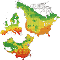 |
57. Species and phylogenetic endemism in angiosperm trees across the Northern Hemisphere are jointly shaped by modern climate and glacial–interglacial climate change Feng G, Ma Z, Sandel B, Mao L, Normand S, Ordonez A & Svenning JC |
Read Abstract |
||
|
Aims |
||||
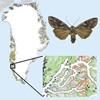 |
56. Immediate and carry-over effects of insect outbreaks on vegetation growth in West Greenland assessed from cells to satellite Prendin AL, Carrer M, Karami M, Hollesen J, Pedersen NB, Pividori M, Treier UA, Westergaard-Nielsen A, Elberling B & Normand S |
Read Abstract |
||
|
Aim
|
||||
 |
55. Macroecology in the age of Big Data – Where to go from here? Wüest RO, Zimmermann NE, Zurell D, Alexander JM, Fritz SA, Hof C, Kreft H, Normand S, Cabral JS, Szekely E, Thuiller W, Wikelski M & Karger DN |
Read Abstract |
||
|
Recent years have seen an exponential increase in the amount of data available in all sciences and application domains. Macroecology is part of this “Big Data” trend, with a strong rise in the volume of data that we are using for our research. Here, we summarize the most recent developments in macroecology in the age of Big Data that were presented at the 2018 annual meeting of the Specialist Group Macroecology of the Ecological Society of Germany, Austria and Switzerland (GfÖ). Supported by computational advances, macroecology has been a rapidly developing field over recent years. Our meeting highlighted important avenues for further progress in terms of standardized data collection, data integration, method development and process integration. In particular, we focus on (a) important data gaps and new initiatives to close them, for example through space‐ and airborne sensors, (b) how various data sources and types can be integrated, (c) how uncertainty can be assessed in data‐driven analyses and (d) how Big Data and machine learning approaches have opened new ways of investigating processes rather than simply describing patterns. We discuss how Big Data opens up new opportunities, but also poses new challenges to macroecological research. In the future, it will be essential to carefully assess data quality, the reproducibility of data compilation and analytical methods, and the communication of uncertainties. Major progress in the field will depend on the definition of data standards and workflows for macroecology, such that scientific quality and integrity are guaranteed, and collaboration in research projects is made easier.
|
||||
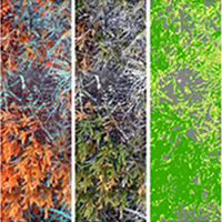 |
54. Transferability and the effect of colour calibration during multi-image classification of Arctic vegetation change Kolyaie S, Treier UA, Watmough GR, Madsen B, Bøcher PK, Psomas A, Bösch R & Normand S |
Read Abstract |
||
|
Mapping changes in vegetation cover is essential for understanding the consequences of climate change on Arctic ecosystems. Classification of ultra-high spatial-resolution (UHR, <1cm) imagery can provide estimates of vegetation cover across space and time. The challenge of this approach is to assure comparability of classification across many images taken at different illumination conditions and locations. With warming, vegetation at higher elevation is expected to resemble current vegetation at lower elevation. To investigate the value of classification of UHR imagery for monitoring vegetation change, we collected visible and near infrared images from 108 plots with handheld cameras along an altitudinal gradient in Greenland and examined the classification accuracy of shrub cover on independent images (i.e. classification transferability). We implemented several models to examine if colour calibration improves transferability based on an in-image calibration target. The classifier was trained on different number of images to find the minimum training subset size. With a training set of ~20% of the images the overall accuracy levelled off at about 81% and 68% on the non-calibrated training and validation images, respectively. Colour calibration improved the accuracy on training images (1-4%) while it only improved the classifier transferability significantly for training sets <20%. Linear calibration only based on the target's grey series improved transferability most. Reasonable transferability of Arctic shrub cover classification can be obtained based only on spectral data and about 20% of all images. This is promising for vegetation monitoring through multi-image classification of UHR imagery acquired with hand-held cameras or Unmanned Aerial Systems. |
||||
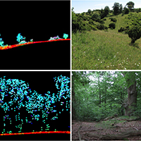 |
53. Light detection and ranging explains diversity of plants, fungi, lichens, and bryophytes across multiple habitats and large geographic extent. Moeslund JE, Zlinszky A, Ejrnæs R, Brunbjerg AK, Bøcher PK, Svenning JC & Normand S |
Read Abstract |
||
|
Effective planning and nature management require spatially accurate and comprehensive measures of the factors important for biodiversity. Light detection and ranging (LIDAR) can provide exactly this, and is therefore a promising technology to support future nature management and related applications. However, until now studies evaluating the potential of LIDAR for this field have been highly limited in scope. Here, we assess the potential of LIDAR to estimate the local diversity of four species groups in multiple habitat types, from open grasslands and meadows over shrubland to forests and across a large area (~43,000 km2), providing a crucial step toward enabling the application of LIDAR in practice, planning, and policy‐making. We assessed the relationships between the species richness of macrofungi, lichens, bryophytes, and plants, respectively, and 25 LIDAR‐based measures related to potential abiotic and biotic diversity drivers. We used negative binomial generalized linear modeling to construct 19 different candidate models for each species group, and leave-one-region-out cross validation to select the best models. These best models explained 49%, 31%, 32%, and 28% of the variation in species richness (R2) for macrofungi, lichens, bryophytes, and plants, respectively. Three LIDAR measures, terrain slope, shrub layer height and variation in local heat load, were important and positively related to the richness in three of the four species groups. For at least one of the species groups, four other LIDAR measures, shrub layer density, medium-tree layer density, and variations in point amplitude and in relative biomass, were among the three most important. Generally, LIDAR measures exhibited strong associations to the biotic environment, and to some abiotic factors, but were poor measures of spatial landscape and temporal habitat continuity. In conclusion, we showed how well LIDAR alone can predict the local biodiversity across habitats. We also showed that several LIDAR measures are highly correlated to important biodiversity drivers, which are notoriously hard to measure in the field. This opens up hitherto unseen possibilities for using LIDAR for cost-effective monitoring and management of local biodiversity across species groups and habitat types even over large areas. |
||||
 |
52. Status and trends in Arctic vegetation: Evidence from experimental warming and long-term monitoring Bjorkman AD, Criado MG, Myers-Smith IH, Ravolainen V, Jónsdóttir IS, Westergaard KB, Lawler J, Aronsson M, Bennett B, Gardfjell H, Heiðmarsson S, Stewart L & Normand S |
Read Abstract |
||
|
Changes in Arctic vegetation can have important implications for trophic interactions and ecosystem functioning leading to climate feedbacks. Plot-based vegetation surveys provide detailed insight into vegetation changes at sites around the Arctic and improve our ability to predict the impacts of environmental change on tundra ecosystems. Here, we review studies of changes in plant community composition and phenology from both long-term monitoring and warming experiments in Arctic environments. We find that Arctic plant communities and species are generally sensitive to warming, but trends over a period of time are heterogeneous and complex and do not always mirror expectations based on responses to experimental manipulations. Our findings highlight the need for more geographically widespread, integrated, and comprehensive monitoring efforts that can better resolve the interacting effects of warming and other local and regional ecological factors. |
||||
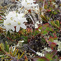 |
51. Traditional plant functional groups explain variation in economic but not size-related traits across the tundra biome Thomas HJD, Myers-Smith IH, Bjorkman AD, Elmendorf SC et al. |
Read Abstract |
||
|
Aim Plant functional groups are widely used in community ecology and earth system modelling to describe trait variation within and across plant communities. However, this approach rests on the assumption that functional groups explain a large proportion of trait variation among species. We test whether four commonly used plant functional groups represent variation in six ecologically important plant traits.
Location Tundra biome.
Time period Data collected between 1964 and 2016.
Major taxa studied 295 tundra vascular plant species.
Methods We compiled a database of six plant traits (plant height, leaf area, specific leaf area, leaf dry matter content, leaf nitrogen, seed mass) for tundra species. We examined the variation in species-level trait expression explained by four traditional functional groups (evergreen shrubs, deciduous shrubs, graminoids, forbs), and whether variation explained was dependent upon the traits included in analysis. We further compared the explanatory power and species composition of functional groups to alternative classifications generated using post hoc clustering of species-level traits.
Results Traditional functional groups explained significant differences in trait expression, particularly amongst traits associated with resource economics, which were consistent across sites and at the biome scale. However, functional groups explained 19% of overall trait variation and poorly represented differences in traits associated with plant size. Post hoc classification of species did not correspond well with traditional functional groups, and explained twice as much variation in species-level trait expression.
Main conclusions Traditional functional groups only coarsely represent variation in well-measured traits within tundra plant communities, and better explain resource economic traits than size-related traits. We recommend caution when using functional group approaches to predict tundra ecosystem change, or ecosystem functions relating to plant size, such as albedo or carbon storage. We argue that alternative classifications or direct use of specific plant traits could provide new insight into ecological prediction and modelling.
Keywords: cluster analysis • community composition • ecosystem function • plant functional groups • plant functional types • plant traits • tundra biome • vegetation change |
||||
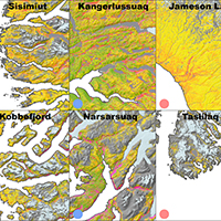 |
50. A phenology-based approach to the classification of Arctic tundra ecosystems in Greenland Karami M, Westergaard-Nielsen A, Normand S, Treier UA, Elberling B & Hansen BU |
Read Abstract |
||
|
The disproportionate warming in the Arctic and the resulting adverse ecosystem changes underline the importance of continued monitoring of these ecosystems. Land-cover classification maps of the Arctic regions are essential for monitoring and change detection purposes, as well as upscaling of various ecosystem processes. However, large-scale land cover maps of the Arctic regions are often too coarse to properly capture the heterogeneity of these landscapes. In this study, we bridge this gap through incorporating multi temporal Landsat-8 OLI data in a large-scale land cover classification, and subsequently produce a tundra classification map for the entire Greenland. An algorithm is developed that allows for the extraction of vegetation phenology from single-year time series of 4169 OLI scenes at 30 m resolution despite the low revisit frequency of the satellite and persistent cloud cover. The phenological metrics, satellite-derived wetness, and terrain information are then used to separate land surface classes using a random forest classifier. The optimal algorithm parameters and input layers are identified, ultimately yielding a cross-validation accuracy of 89.25% across the studied area. Finally, we have conducted a comprehensive analysis on the resulting land-cover map and for the first time presented the geographical distribution, latitudinal gradients, and climate linkages of the various tundra vegetation classes across the ice-free part of Greenland. With a resolution of 30 m and Greenland-wide spatial coverage, the produced land-cover map can support various applications at scales ranging from the landscape to regional level. Keywords: Tundra classification • Vegetation phenology • Random forest • Arctic vegetation • Greenland • Landsat time series |
||||
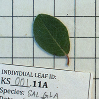 |
49. Tundra Trait Team: A database of plant traits spanning the tundra biome Bjorkman AD, Myers-Smith IH, Elmendorf SC, Normand S, Thomas HJD et al. |
Read Abstract |
||
|
Motivation The Tundra Trait Team (TTT) database includes field-based measurements of key traits related to plant form and function at multiple sites across the tundra biome. This dataset can be used to address theoretical questions about plant strategy and trade-offs, trait–environment relationships and environmental filtering, and trait variation across spatial scales, to validate satellite data, and to inform Earth system model parameters. Main types of variable contained The database contains 91,970 measurements of 18 plant traits. The most frequently measured traits (> 1,000 observations each) include plant height, leaf area, specific leaf area, leaf fresh and dry mass, leaf dry matter content, leaf nitrogen, carbon and phosphorus content, leaf C:N and N:P, seed mass, and stem specific density. Spatial location and grain Measurements were collected in tundra habitats in both the Northern and Southern Hemispheres, including Arctic sites in Alaska, Canada, Greenland, Fennoscandia and Siberia, alpine sites in the European Alps, Colorado Rockies, Caucasus, Ural Mountains, Pyrenees, Australian Alps, and Central Otago Mountains (New Zealand), and sub-Antarctic Marion Island. More than 99% of observations are georeferenced. Time period and grain All data were collected between 1964 and 2018. A small number of sites have repeated trait measurements at two or more time periods. Major taxa and level of measurement Trait measurements were made on 978 terrestrial vascular plant species growing in tundra habitats. Most observations are on individuals (86%), while the remainder represent plot or site means or maximums per species. Software format csv file and GitHub repository with data cleaning scripts in R; contribution to TRY plant trait database (www.try-db.org) to be included in the next version release.
Keywords: Arctic • tundra • plant functional traits • database • TRY |
||||
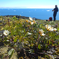 |
48. Plant functional trait change across a warming tundra biome Bjorkman AD, Myers-Smith IH, Elmendorf SC, Normand S, Rüger N et al. |
Read Abstract |
||
|
The tundra is warming more rapidly than any other biome on Earth, and the potential ramifications are far-reaching because of global feedback effects between vegetation and climate. A better understanding of how environmental factors shape plant structure and function is crucial for predicting the consequences of environmental change for ecosystem functioning. Here we explore the biome-wide relationships between temperature, moisture and seven key plant functional traits both across space and over three decades of warming at 117 tundra locations. Spatial temperature–trait relationships were generally strong but soil moisture had a marked influence on the strength and direction of these relationships, highlighting the potentially important influence of changes in water availability on future trait shifts in tundra plant communities. Community height increased with warming across all sites over the past three decades, but other traits lagged far behind predicted rates of change. Our findings highlight the challenge of using space-for-time substitution to predict the functional consequences of future warming and suggest that functions that are tied closely to plant height will experience the most rapid change. They also reveal the strength with which environmental factors shape biotic communities at the coldest extremes of the planet and will help to improve projections of functional changes in tundra ecosystems with climate warming.
|
||||
 |
47. Land-surface greening suggests vigorous woody regrowth throughout European semi-natural vegetation Buitenwerf R, Sandel B, Normand S, Mimet A & Svenning JC |
Read Abstract |
||
|
The satellite record has revealed substantial land-surface “greening” in the northern hemisphere over recent decades. Process-based Earth system models (ESMs) attribute enhanced vegetation productivity (greening) to CO2 fertilisation. However, the models poorly reproduce observed spatial patterns of greening, suggesting that they ignore crucial processes. Here, we explore whether fine-scale land-cover dynamics, as modified by ecological and land-use processes, can explain the discrepancy between models and satellite-based estimates of greening.
|
||||
 |
46. Accelerated increase in plant species richness on mountain summits is linked to warming Steinbauer MJ, Grytnes JA, Jurasinski G, Kulonen A, Lenoir J, Pauli H, Rixen C, Winkler M et al. |
Read Abstract |
||
|
Globally accelerating trends in societal development and human environmental impacts since the mid-twentieth century are known as the Great Acceleration and have been discussed as a key indicator of the onset of the Anthropocene epoch. While reports on ecological responses (for example, changes in species range or local extinctions) to the Great Acceleration are multiplying, it is unknown whether such biotic responses are undergoing a similar acceleration over time. This knowledge gap stems from the limited availability of time series data on biodiversity changes across large temporal and geographical extents. Here we use a dataset of repeated plant surveys from 302 mountain summits across Europe, spanning 145 years of observation, to assess the temporal trajectory of mountain biodiversity changes as a globally coherent imprint of the Anthropocene. We find a continent-wide acceleration in the rate of increase in plant species richness, with five times as much species enrichment between 2007 and 2016 as fifty years ago, between 1957 and 1966. This acceleration is strikingly synchronized with accelerated global warming and is not linked to alternative global change drivers. The accelerating increases in species richness on mountain summits across this broad spatial extent demonstrate that acceleration in climate-induced biotic change is occurring even in remote places on Earth, with potentially far-ranging consequences not only for biodiversity, but also for ecosystem functioning and services.
Keywords: biodiversity • climate-change ecology • climate-change impacts • macroecology • plant sciences |
||||
 |
45. Plant community composition and species richness in the High Arctic tundra: from the present to the future Nabe-Nielsen J, Normand S, Hui FKC, Stewart L, Bay C, Nabe-Nielsen LI & Schmidt NM |
Read Abstract |
||
|
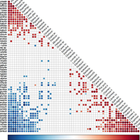
1. Arctic plant communities are altered by climate changes. The magnitude of these alterations depends on the extent to which species distributions are determined by macroclimatic conditions, by factors related to local topography, or by biotic interactions. Our current understanding of the relative importance of these conditions is limited due to the scarcity of landscape-scale studies, especially in the High Arctic. 2. We investigated variations in vascular plant community composition and species richness based on 288 plots distributed on three sites along a High Arctic coast-inland gradient in Northeast Greenland using a stratified random design. We used an information theoretic approach to determine whether variations in species richness within each site were best explained by microclimate, by factors related to local topography (including soil water) or by plant-plant interactions. Latent variable models were used to explain patterns in plant community composition. 3. Species richness was mainly determined by variations in soil water content, explaining 35 % of the variation in number of species, and to a minor degree by other variables related to topography. Species richness was not directly related to macroclimatic conditions. 4. Latent variable models showed that 23.0 % of the variation in community composition was explained by variables related to topography, while distance to the inland ice explained an additional 6.4 %. This indicates that some species are associated with environmental conditions found in only some parts of the coast–inland gradient. Inclusion of macroclimatic variation in the model increased its explanatory power by further 4.2 %. 5. Synthesis. Our results suggest that the main impact of climate changes in the High Arctic will be mediated by their influence on local soil water conditions. Increasing temperatures are likely to cause higher evaporation rates and alter the distribution of late-melting snow patches. This will have little impact on landscape-scale diversity if plants are able to redistribute locally to remain in areas with sufficient soil water.
Keywords: Arctic tundra vegetation • climate change • Latent Variable Models • Northeast Greenland • plant community composition • vascular plant species richness |
||||
 |
44. Legacies of historical human activities in arctic woody plant dynamics Normand S*, Høye TT*, Forbes BC, Bowden JJ, Davies AL, Odgaard BV, Riede F, Svenning JC, |
Read Abstract |
||
|
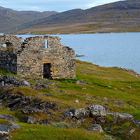
Recent changes in Arctic vegetation might not be driven by climate change alone. Legacies of human activities have received little attention as a contributing factor. We examine the degree to which traditional human activities (hunting, herding, fire, wood extraction, and agriculture) have had lasting effects on arctic woody plant communities, and therefore might continue to affect biome-wide responses to climate change. Evidence suggests that legacies are likely to be evident across meters to hundreds of kilometres and for decades, centuries, and millennia. The evidence, however, is sparse and we highlight that this could be changed with a circum-arctic collaboratory consisting of a network of interdisciplinary field sites, standardised protocols, participatory research, and new approaches. We suggest that human activities should be brought into consideration with respect to understanding the role of human legacies for Arctic vegetation dynamics in general and for variation in woody plant responses to climate change specifically.
Keywords: Arctic • collaboratory • Greenland • human perturbation • shrub community |
||||
 |
43. Xylem anatomical trait variability provides insight on the climate-growth relationship of Betula nana in western Greenland Nielsen SS, von Arx G, Damgaard CF, Abermann J, Buchwal A, Büntgen U, Treier UA, |
Read Abstract |
||
|
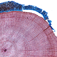
Climate change has been reported to affect shrub growth positively at several sites at high northern latitudes, including several arctic environments. The observed growth rates are, however, not uniform in space and time, and the mechanistic drivers of these patterns remain poorly understood. Here we investigated spatio-temporal interactions between climatic conditions, xylem anatomical traits, and annual growth of 21 Betula nana L. individuals from western Greenland for the period 2001–2011. Structural equation modeling showed that summer precipitation and winter temperature are affecting annual growth positively. Furthermore, vessel lumen area and vessel grouping, which are related to water conductivity and hydraulic connectivity of the xylem, respectively, positively influenced annual growth. To optimize growth B. nana was thus able to adjust its water transporting system. Annual variation in vessel lumen area seemed to be driven mostly by spring and summer temperatures, whereas annual variation in vessel grouping was driven by winter temperature. Linear models did not reveal a pattern in the spatial variation of xylem anatomical traits across the sampled climatic gradient. However, growth was positively correlated with local variation in insolation. Our results suggest that B. nana can adjust its hydraulic capacity to annual fluctuations in climatic conditions in order to optimize its total radial stem growth rate.
Keywords: Greenland • Quantitative Wood Anatomy• Betula nana • ROXAS • Climate Change • Structural Equation Modeling (SEM)
|
||||
 |
42. Glacial survival of trophically linked boreal species in northern Europe Quinzin MC, Normand S, Dellicour S, Svenning JC & Mardulyn P |
Read Abstract |
||
|
Whether non-arctic species persisted in northern Europe during the Last Glacial Maximum (LGM) is highly debated. Until now, the debate has mostly focused on plants, with little consideration for other groups of organisms, e.g. the numerous plant-dependent insect species. Here, we study the late-Quaternary evolution of the European range of a boreo-montane leaf beetle, Gonioctena intermedia, which feeds exclusively on the boreal and temperate trees Prunus padus and Sorbus aucuparia. Using species distribution models, we estimated the congruence between areas of past and present suitable climate for this beetle and its host plants. Then we derived historical hypotheses from the congruent range estimates, and evaluated their compatibility with observed DNA sequence variation at five independent loci. We investigated compatibility using computer simulations of population evolution under various coalescence models. We find strong evidence for range modifications in response to late-Quaternary climate changes, and support for the presence of populations of G. intermedia in northern Europe since the beginning of the last glaciation. The presence of a co-dependent insect in the region through the LGM provides new evidence supporting the glacial survival of cold-tolerant tree species in northern Europe.
Keywords: Quarternary • Species distribution models (SDM) • Leaf beetle • PhyloGeoSim • Approximate Bayesian Computation(ABC) |
||||
 |
41. Background invertebrate herbivory on dwarf birch (Betula glandulosa-nana complex) increases with temperature and precipitation across the tundra biome Barrio IC, Lindén E, Te Beest M et al. |
Read Abstract |
||
|
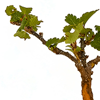
Chronic, low intensity herbivory by invertebrates, termed background herbivory, has been understudied in tundra, yet its impacts are likely to increase in a warmer Arctic. The magnitude of these changes is however hard to predict as we know little about the drivers of current levels of invertebrate herbivory in tundra. We assessed the intensity of invertebrate herbivory on a common tundra plant, the dwarf birch (Betula glandulosa-nana complex), and investigated its relationship to latitude and climate across the tundra biome. Leaf damage by defoliating, mining and gall-forming invertebrates was measured in samples collected from 192 sites at 56 locations. Our results indicate that invertebrate herbivory is nearly ubiquitous across the tundra biome but occurs at low intensity. On average, invertebrates damaged 11.2% of the leaves and removed 1.4% of total leaf area. The damage was mainly caused by external leaf feeders, and most damaged leaves were only slightly affected (12% leaf area lost). Foliar damage was consistently positively correlated with mid-summer (July) temperature and, to a lesser extent, precipitation in the year of data collection, irrespective of latitude. Our models predict that, on average, foliar losses to invertebrates on dwarf birch are likely to increase by 6–7% over the current levels with a 1°C increase in summer temperatures. Our results show that invertebrate herbivory on dwarf birch is small in magnitude but given its prevalence and dependence on climatic variables, background invertebrate herbivory should be included in predictions of climate change impacts on tundra ecosystems.
Keywords: Background insect herbivory • Climate change • Externally feeding defoliators • Latitudinal Herbivory Hypothesis • Leaf damage • Leaf miners • Gall makers • Macroecological pattern |
||||
 |
40. Phylogenetic age differences in tree assemblages across the Northern Hemisphere increase with long-term climate stability in unstable regions Feng G, Ma Z, Benito BM, Normand S, Ordonez A, Jin Y, Mao L & Svenning JC |
Read Abstract |
||
|
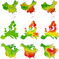
Aims: Long-term climate stability is hypothesized to drive the emergence of species assemblages with large species age differences due to the accumulation of relict species and relatively newly arisen species via reduced extinction and increased speciation. Few studies have addressed these predictions and so far no study has done so for plants across the Northern Hemisphere. Here, we linked Quaternary-scale climate variability to phylogenetic age differences between the oldest and youngest group of species in tree assemblages in 100 km × 100 km grid cells across the Northern Hemisphere to test these predictions. Location: Northern Hemisphere. Methods: Last Glacial Maximum (LGM)-to-present shifts in temperature and precipitation were used as proxies for Quaternary-scale glacial–interglacial climate variability. Simultaneous autoregressive (SAR) models were used to assess the relationships between phylogenetic age differences and Quaternary-scale climate variability. Results: We found that phylogenetic age differences overall were largest in China and smallest in Europe, and they declined with increasing temperature instability as predicted, but only in Europe and North America. In China, the relatively mild Quaternary climate changes did not appear to have strongly affected phylogenetic age differences in tree assemblages. Main conclusions: Our results show that phylogenetically diverse assemblages with large phylogenetic age differences among species are associated with relatively high long-term climate stability, with intra-regional links between long-term climate variability and phylogenetic composition especially strong in the more unstable regions. These findings point to future climate change as a key risk to the preservation of the phylogenetically diverse assemblages in regions characterized by relatively high paleoclimate stability, with China as a key example.
Keywords: extinction • Northern Hemisphere • phylogenetic age differences • Quaternary-scale climate variability • speciation • tree assemblage |
||||
 |
39. Phylogeny and the prediction of tree functional diversity across novel continental settings Swenson NG, Weiser MD, Mao L, Araújo MB, Diniz-Filho JAF, Kollmann J, Nogués-Bravo D, |
Read Abstract |
||
|
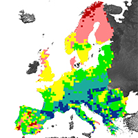
Aim: Mapping the distribution and diversity of plant functional traits is critical for projecting future changes to vegetation under global change. Maps of plant functional traits, however, are scarce due very sparse global trait data matrices. A potential solution to this data limitation is to utilize the known levels of phylogenetic signal in trait data to predict missing values. Here we aim to test existing phylogenetic comparative methods for imputing missing trait data for the purpose of producing continental-scale maps of plant functional traits. Location: North America and Europe. Methods: Phylogenetic imputation models and trait data from one continent were used to predict the trait values for tree species on the other continent and to produce trait maps. Predicted maps of trait means, variances and functional diversity were compared with known maps to quantify the degree to which predicted trait values could estimate spatial patterns of trait distributions and diversity. Results: We show that the phylogenetic signal in plant functional trait data can be used to provide robust predictions of the geographical distribution of tree functional diversity. However, predictions for traits with little phylogenetic signal, such as maximum height, are error prone. Lastly, trait imputation methods based on phylogenetic generalized least squares tended to outperform those based on phylogenetic eigenvectors. Main conclusions: It is possible to predict patterns of functional diversity across continental settings with novel species assemblages for most of the traits studied for which we have no direct trait information, thereby offering an effective method for overcoming a key data limitation in global change biology, macroecology and ecosystem modelling.
Keywords: Forest ecology • imputation • plant biodiversity • phylogeny • temperate forest • trait biogeography |
||||
 |
38. Meter scale variation in shrub dominance and soil moisture structure arctic arthropod communities Hansen RR, Hansen OLP, Bowden JJ, Treier UA, Normand S & Høye T |
Read Abstract |
||
|
The Arctic is warming at twice the rate of the rest of the world. This impacts Arctic species both directly, through increased temperatures, and indirectly, through structural changes in their habitats. Species are expected to exhibit idiosyncratic responses to structural change, which calls for detailed investigations at the species and community level. Here, we investigate how arthropod assemblages of spiders and beetles respond to variation in habitat structure at small spatial scales. We sampled transitions in shrub dominance and soil moisture between three different habitats (fen, dwarf shrub heath, and tall shrub tundra) at three different sites along a fjord gradient in southwest Greenland, using yellow pitfall cups. We identified 2,547 individuals belonging to 47 species. We used species richness estimation, indicator species analysis and latent variable modeling to examine differences in arthropod community structure in response to habitat variation at local (within site) and regional scales (between sites). We estimated species responses to the environment by fitting species-specific generalized linear models with environmental covariates. Species assemblages were segregated at the habitat and site level. Each habitat hosted significant indicator species, and species richness and diversity were significantly lower in fen habitats. Assemblage patterns were significantly linked to changes in soil moisture and vegetation height, as well as geographic location. We show that meter-scale variation among habitats affects arthropod community structure, supporting the notion that the Arctic tundra is a heterogeneous environment. To gain sufficient insight into temporal biodiversity change, we require studies of species distributions detailing species habitat preferences.
Keywords: Biodiversity • Biogeography • Conservation Biology • Ecology • Entomology |
||||
 |
37. High spatial variation in terrestrial arthropod species diversity and composition near the Greenland ice cap Hansen RR, Hansen OLP, Bowden JJ, Normand S, Bay C, Sørensen JG & Høye TT |
Read Abstract |
||
|
Arthropods form a major part of the terrestrial species diversity in the Arctic, and are particularly sensitive to temporal changes in the abiotic environment. It is assumed that most Arctic arthropods are habitat generalists and that their diversity patterns exhibit low spatial variation. The empirical basis for this assumption, however, is weak. We examine the degree of spatial variation in species diversity and assemblage structure among five habitat types at two sites of similar abiotic conditions and plant species composition in southwest Greenland, using standardized field collection methods for spiders, beetles and butterflies. We employed non-metric multidimensional scaling, species richness estimation, community dissimilarity and indicator species analysis to test for local (within site)- and regional (between site)-scale differences in arthropod communities. To identify specific drivers of local arthropod assemblages, we used a combination of ordination techniques and linear regression. Species richness and the species pool differed between sites, with the latter indicating high species turnover. Local-scale assemblage patterns were related to soil moisture and temperature. We conclude that Arctic arthropod species assemblages vary substantially over short distances due to local soil characteristics, while regional variation in the species pool is likely influenced by geographic barriers, i.e., inland ice sheet, glaciers, mountains and large water bodies. In order to predict future changes to Arctic arthropod diversity, further efforts are needed to disentangle contemporary drivers of diversity at multiple spatial scales.
Keywords: Araneae • Biodiversity • Climate change • Coleoptera • Habitat heterogeneity • Lepidoptera
|
||||
 |
36. Benchmarking novel approaches for modelling species range dynamics Zurell D, Thuiller W, Pagel J, Cabral JS, Münkemüller T, Gravel D, Dullinger S, Normand S, Schiffers KH, Moore KA & Zimmermann NE |
Read Abstract |
||
|
Increasing biodiversity loss due to climate change is one of the most vital challenges of the 21st century. To anticipate and mitigate biodiversity loss, models are needed that reliably project species’ range dynamics and extinction risks. Recently, several new approaches to model range dynamics have been developed to supplement correlative species distribution models (SDMs), but applications clearly lag behind model development. Indeed, no comparative analysis has been performed to evaluate their performance. Here, we build on process-based, simulated data for benchmarking five range (dynamic) models of varying complexity including classical SDMs, SDMs coupled with simple dispersal or more complex population dynamic models (SDM hybrids), and a hierarchical Bayesian process-based dynamic range model (DRM). We specifically test the effects of demographic and community processes on model predictive performance. Under current climate, DRMs performed best, although only marginally. Under climate change, predictive performance varied considerably, with no clear winners. Yet, all range dynamic models improved predictions under climate change substantially compared to purely correlative SDMs, and the population dynamic models also predicted reasonable extinction risks for most scenarios. When benchmarking data were simulated with more complex demographic and community processes, simple SDM hybrids including only dispersal often proved most reliable. Finally, we found that structural decisions during model building can have great impact on model accuracy, but prior system knowledge on important processes can reduce these uncertainties considerably. Our results reassure the clear merit in using dynamic approaches for modelling species’ response to climate change but also emphasize several needs for further model and data improvement. We propose and discuss perspectives for improving range projections through combination of multiple models and for making these approaches operational for large numbers of species.
Keywords: climate change • demographic models • dispersal • population viability • prediction • simulated data • species distribution models • virtual ecologist approach |
||||
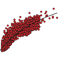 |
35. Constancy in functional space across a species richness anomaly Swenson NG, Weiser MD, Mao L, Normand S, Rodriguez MA, Lin L, Cao M & Svenning JC |
Read Abstract |
||
|
The relationship between large-scale gradients in species richness and functional diversity provides important information regarding the mechanisms driving patterns of biodiversity. A classic hypothesis in ecology is that strong interspecific interactions should result in an increase in the functional volume of assemblages as the species richness increases, whereas climatic constraints may result in no change in functional volume. Most research of this kind examines latitudinal gradients in species richness, but the results are likely confounded by underlying gradients in climate and phylogenetic composition. We take an alternative approach that examines functional richness across a tree species richness anomaly where species richness doubles from Europe to eastern North America. The results demonstrate that the functional richness on both continents saturates at a similar point as species richness increases and that the packing of functional space becomes tighter. Further, the species richness anomaly is driven primarily by genera unique to North America, but those genera contribute less than expected functional richness to the region, indicating a high level of redundancy with genera shared between the continents. Taken together, the results indicate that the species richness anomaly is associated with diversification within a climatically constrained trait space. More generally, the work demonstrates the power of utilizing species richness anomalies in biodiversity research, particularly when they are coupled with information regarding organismal function. Keywords: diversity anomaly • functional diversity • functional traits • species richness • temperate trees • trait space |
||||
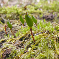 |
34. The mossy north: An inverse latitudinal diversity gradient in European bryophytes Mateo RG, Broennimann O, Normand S, Petitpierre B, Araújo MB, Svenning JC, Baselga A, |
Read Abstract |
||
|
It remains hotly debated whether latitudinal diversity gradients are common across taxonomic groups and whether a single mechanism can explain such gradients. Investigating species richness (SR) patterns of European land plants, we determine whether SR increases with decreasing latitude, as predicted by theory, and whether the assembly mechanisms differ among taxonomic groups. SR increases towards the south in spermatophytes, but towards the north in ferns and bryophytes. SR patterns in spermatophytes are consistent with their patterns of beta diversity, with high levels of nestedness and turnover in the north and in the south, respectively, indicating species exclusion towards the north and increased opportunities for speciation in the south. Liverworts exhibit the highest levels of nestedness, suggesting that they represent the most sensitive group to the impact of past climate change. Nevertheless, although the extent of liverwort species turnover in the south is substantially and significantly lower than in spermatophytes, liverworts share with the latter a higher nestedness in the north and a higher turn-over in the south, in contrast to mosses and ferns. The extent to which the similarity in the patterns displayed by spermatophytes and liverworts reflects a similar assembly mechanism remains, however, to be demonstrated.
Keywords: bryophytes • latitudinal diversity gradient (LDG) • stacked species distribution models (S-SDMs) • species richness • species turnover |
||||
 |
33. Past climate-driven range shifts and population genetic diversity in arctic plants Pellissier L et al. |
Read Abstract |
||
|
Aim: High intra-specific genetic diversity is necessary for species adaptation to novel environments under climate change, but species tracking suitable conditions are losing alleles through successive founder events during range shift. Here, we investigated the relationship between range shift since the Last Glacial Maximum (LGM) and extant population genetic diversity across multiple plant species to understand variability in species responses. Location: The circumpolar Arctic and northern temperate alpine ranges. Methods: We estimated the climatic niches of 30 cold-adapted plant species using range maps coupled with species distribution models and hindcasted species suitable areas to reconstructions of the mid-Holocene and LGM climates. We computed the species-specific migration distances from the species glacial refugia to their current distribution and correlated distances to extant genetic diversity in 1295 populations. Differential responses among species were related to life-history traits. Results: We found a negative association between inferred migration distances from refugia and genetic diversities in 25 species, but only 11 had statistically significant negative slopes. The relationships between inferred distance and population genetic diversity were steeper for insect-pollinated species than wind-pollinated species, but the difference among pollination system was marginally independent from phylogenetic autocorrelation. Main conclusion: The relationships between inferred migration distances and genetic diversities in 11 species, independent from current isolation, indicate that past range shifts were associated with a genetic bottleneck effect with an average of 21% loss of genetic diversity per 1000 km-1. In contrast, the absence of relationship in many species also indicates that the response is species specific and may be modulated by plant pollination strategies or result from more complex historical contingencies than those modelled here.
Keywords: Arctic plants • climate change • climatic niche • Last Glacial Maximum • migration • species distribution models |
||||
 |
32. The influence of paleoclimate on present-day patterns in biodiversity and ecosystems Svenning JC, Eiserhardt WL, Normand S, Ordonez A & Sandel B |
Read Abstract |
||
|
Earth's climate has experienced strong changes on timescales ranging from decades to millions of years. As biodiversity has evolved under these circumstances, dependence on these climate dynamics is expected. In this review, we assess the current state of knowledge on paleoclimatic legacies in biodiversity and ecosystem patterns. Paleoclimate has had strong impacts on past biodiversity dynamics, driving range shifts and extinctions as well as diversification. We outline theory for how these dynamics may have left legacies in contemporary patterns and review the empirical evidence. We report ample evidence that Quaternary glacial–interglacial climate change affects current patterns of species distributions and diversity across a broad range of organisms and regions. We also report emerging evidence for paleoclimate effects on current patterns in phylogenetic and functional diversity and ecosystem functioning and for legacies of deeper-time paleoclimate conditions. Finally, we discuss implications for Anthropocene ecology and outline an agenda to improve our understanding of paleoclimate's role in shaping contemporary biodiversity and ecosystems.
Keywords: climate change • disequilibrium dynamics • dispersal limitation • functional and phylogenetic diversity • history • species distributions • species richness |
||||
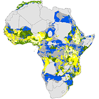 |
31. Global-change vulnerability of a key plant resource, the African palms Blach-Overgaard A, Balslev H, Dransfield J, Normand S & Svenning JC |
Read Abstract |
||
|
Palms are keystone species in tropical ecosystems and provide essential ecosystem services to rural people worldwide. However, many palm species are threatened by habitat loss and over-exploitation. Furthermore, palms are sensitive to climate and thus vulnerable to future climate changes. Here, we provide a first quantitative assessment of the future risks to the African palm flora, finding that African palm species on average may experience a decline in climatic suitability in >70% of their current ranges by 2080. This suitability loss may, however, be almost halved if migration to nearby climatically suitable sites succeeds. Worryingly, 42% of the areas with 80–100% of species losing climate suitability are also characterized by high human population density (HPD). By 2080, >90% of all African palm species’ ranges will likely occur at HPDs leading to increased risks of habitat loss and overexploitation. Additionally, up to 87% of all species are predicted to lose climatic suitability within current protected areas (PAs) by 2080. In summary, a major plant component of tropical ecosystems and provider of ecosystem services to rural populations will face strongly increased pressures from climate change and human populations in the near future. Keywords: biogeography • climate-change ecology • ecological modelling |
||||
 |
30. Temperature-induced recruitment pulses of Arctic dwarf shrub communities Büntgen U, Hellmann L, Tegel W, Normand S, Myers-Smith I, Kirdyanov AV, Nievergelt D & |
Read Abstract |
||
|
1. The effects of climate change on Arctic ecosystems can range between various spatiotemporal scales and may include shifts in population distribution, community composition, plant phenology, primary productivity and species biodiversity. The growth rates and age structure of tundra vegetation as well as its response to temperature variation, however, remain poorly understood because high-resolution data are limited in space and time. 2. Anatomical and morphological stem characteristics were recorded to assess the growth behaviour and age structure of 871 dwarf shrubs from 10 species at 30 sites in coastal East Greenland at ˜70°N. Recruitment pulses were linked with changes in mean annual and summer temperature back to the 19th century, and a literature review was conducted to place our findings in a pan-Arctic context. 3. Low cambial activity translates into estimated average/maximum plant ages of 59/204 years, suggesting relatively small turnover rates and stable community composition. Decade-long changes in the recruitment intensity were found to lag temperature variability by 2 and 6 years during warmer and colder periods, respectively (r = 0.851961–2000 and 1881–1920). 4. Synthesis. Our results reveal a strong temperature dependency of Arctic dwarf shrub reproduction, a high vulnerability of circumpolar tundra ecosystems to climatic changes, and the ability of evaluating historical vegetation dynamics well beyond the northern treeline. The combined wood anatomical and plant ecological approach, considering insights from micro-sections to community assemblages, indicates that model predictions of rapid tundra expansion (i.e. shrub growth) following intense warming might underestimate plant longevity and persistence but overestimate the sensitivity and reaction time of Arctic vegetation.
Keywords: Arctic tundra • cambial activity • climate change • dendroecology • dwarf shrubs • East Greenland • plant longevity • plant population and community dynamics • vegetation dynamics • wood anatomy |
||||
 |
29. Demography as the basis for understanding and predicting range dynamics Normand S, Zimmermann NE, Schurr FM & Lischke H |
Read Abstract |
||
|
Demographic processes and demographic data are increasingly being included in models of the spatio–temporal dynamics of species’ ranges. In this special issue, we explore how the integration of demographic processes further the conceptual understanding and prediction of species’ range dynamics. The 12 papers originate from two workshops entitled ‘Advancing concepts and models of species range dynamics: understanding and disentangling processes across scales’. The papers combine theoretical and empirical evidence for the interplay between environmental conditions, species interactions, demographic processes (births, deaths, dispersal), physiology, and evolution, and they point out promising avenues towards a better understanding and prediction of species’ range dynamics.
Special Issue: The papers in this special issue arose from two workshops entitled “Advancing concepts and models of species range dynamics: understanding and disentangling processes across scales. |
||||
 |
28. KISSMig – a simple model for R to account for limited migration in analyses of species distributions Nobis M & Normand S |
Read Abstract |
||
|
Detecting the legacy of time-lagged migration in species ranges is an urgent matter for understanding range dynamics. KISSMig is a simple migration model which generates maps of accessibility from areas of origin and allows the generation and testing of hypotheses about the influence of specific spread patterns on species distributions. KISSMig has important applications: 1) uncovering the influence of limited migration relative to other drivers, 2) detecting areas of origin and their importance as sources of migration, and 3) accounting for limited migration in modeling species distributions. Here we introduce KISSMig and use the oak species Quercus cerris to illustrate these applications.
Keywords: R package • Keep It Simple, Stupid Migration model (KISSMig) |
||||
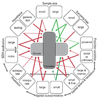 |
27. What do we gain from simplicity versus complexity in species distribution models? Merow C, Smith MJ, Edwards Jr TC, Guisan A, Normand S, Thuiller W, Wüest R, |
Read Abstract |
||
|
Species distribution models (SDMs) are widely used to explain and predict species ranges and environmental niches. They are most commonly constructed by inferring species' occurrence–environment relationships using statistical and machine-learning methods. The variety of methods that can be used to construct SDMs (e.g. generalized linear/additive models, tree-based models, maximum entropy, etc.), and the variety of ways that such models can be implemented, permits substantial flexibility in SDM complexity. Building models with an appropriate amount of complexity for the study objectives is critical for robust inference. We characterize complexity as the shape of the inferred occurrence–environment relationships and the number of parameters used to describe them, and search for insights into whether additional complexity is informative or superfluous. By building ‘under fit’ models, having insufficient flexibility to describe observed occurrence–environment relationships, we risk misunderstanding the factors shaping species distributions. By building ‘over fit’ models, with excessive flexibility, we risk inadvertently ascribing pattern to noise or building opaque models. However, model selection can be challenging, especially when comparing models constructed under different modeling approaches. Here we argue for a more pragmatic approach: researchers should constrain the complexity of their models based on study objective, attributes of the data, and an understanding of how these interact with the underlying biological processes. We discuss guidelines for balancing under fitting with over fitting and consequently how complexity affects decisions made during model building. Although some generalities are possible, our discussion reflects differences in opinions that favor simpler versus more complex models. We conclude that combining insights from both simple and complex SDM building approaches best advances our knowledge of current and future species ranges. Keywords: Species distribution models (SDMs) • Niche description vs • Range mapping • Hypothesis generation • Spatial autocorrelation |
||||
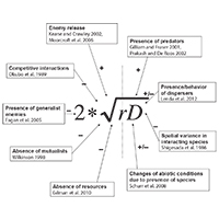 |
26. The influence of interspecific interactions on species range expansion rates Svenning JC, Holt RD, Gravel D, Edwards Jr TC, Higgins SI, Thuiller W, Dullinger S, |
Read Abstract |
||
|
Ongoing and predicted global change makes understanding and predicting species' range shifts an urgent scientific priority. Here, we provide a synthetic perspective on the so far poorly understood effects of interspecific interactions on range expansion rates. We present theoretical foundations for how interspecific interactions may modulate range expansion rates, consider examples from empirical studies of biological invasions and natural range expansions as well as process-based simulations, and discuss how interspecific interactions can be more broadly represented in process-based, spatiotemporally explicit range forecasts. Theory tells us that interspecific interactions affect expansion rates via alteration of local population growth rates and spatial displacement rates, but also via effects on other demographic parameters. The best empirical evidence for interspecific effects on expansion rates comes from studies of biological invasions. Notably, invasion studies indicate that competitive dominance and release from specialized enemies can enhance expansion rates. Studies of natural range expansions especially point to the potential for competition from resident species to reduce expansion rates. Overall, it is clear that interspecific interactions may have important consequences for range dynamics, but also that their effects have received too little attention to robustly generalize on their importance. We then discuss how interspecific interactions effects can be more widely incorporated in dynamic modeling of range expansions. Importantly, models must describe spatiotemporal variation in both local population dynamics and dispersal. Finally, we derive the following guidelines for when it is particularly important to explicitly represent interspecific interactions in dynamic range expansion forecasts: if most interacting species show correlated spatial or temporal trends in their effects on the target species, if the number of interacting species is low, and if the abundance of one or more strongly interacting species is not closely linked to the abundance of the target species. Keywords: Fisher–Skellam model • Range expansion |
||||
 |
25. Environmental and historical imprints on beta diversity: insights from variation in rates of species turnover along gradients Fitzpatrick MC, Sanders NJ, Normand S, Svenning JC, Ferrier S, Gove AD & Dunn RR Proceedings of the Royal Society B, 280: 20131201 (2013) |
Read Abstract |
||
|
A common approach for analysing geographical variation in biodiversity involves using linear models to determine the rate at which species similarity declines with geographical or environmental distance and comparing this rate among regions, taxa or communities. Implicit in this approach areweakly justified assumptions that the rate of species turnover remains constant along gradients and that this rate can therefore serve as a means to compare ecological systems. We use generalized dissimilarity modelling, a novel method that accommodates variation in rates of species turnover along gradients and between different gradients, to compare environmental and spatial controls on the floras of two regions with contrasting evolutionary and climatic histories: southwest Australia and northern Europe. We find stronger signals of climate history in the northern European flora and demonstrate that variation in rates of species turnover is persistent across regions, taxa and different gradients. Such variation may represent an important but often overlooked component of biodiversity that complicates comparisons of distance–decay relationships and underscores the importance of using methods that accommodate the curvilinear relationships expected when modelling beta diversity. Determining how rates of species turnover vary along and between gradients is relevant to understanding the sensitivity of ecological systems to environmental change.
|
||||
 |
24. A greener Greenland? Climatic potential and long-term constraints on future expansions of trees and shrubs Normand S, Randin C, Ohlemüller R, Bay C, Høye TT, Kjær ED, Körner C, Lischke H, Maiorano L, Paulsen J, Pearman PB, Psomas A, Treier UA, Zimmermann NE & Svenning JC |
Read Abstract |
||
|
Warming-induced expansion of trees and shrubs into tundra vegetation will strongly impact Arctic ecosystems. Today, a small subset of the boreal woody flora found during certain Plio- Pleistocene warm periods inhabits Greenland. Whether the 21st century warming will induce a re-colonisation of a rich woody flora depends on the roles of climate and migration limitations in shaping species ranges. Using potential tree-line and climatic niche modelling, we project shifts in areas climatically suitable for tree growth and 56 Greenlandic, North American and European tree and shrub species from the Last Glacial Maximum through the present and into the future. In combination with observed tree plantings, our modelling highlights that a majority of the non-native species find climatically suitable conditions in certain parts of Greenland today, even in areas harbouring no native trees. Analyses of analog climates indicate that these conditions are widespread outside Greenland, thus increasing the likelihood of woody invasions. Nonetheless, we find a substantial migration lag for Greenland’s current and future woody flora. In conclusion, the projected climatic scope for future expansions is strongly limited by dispersal, soil development, and other disequilibrium dynamics, with plantings and unintentional seed dispersal by humans having potentially large impacts on spread rates. Keywords: arctic • climatic niche modelling • climate change impact • disequilibrium • postglacial re-colonisation • shrub expansion |
||||
 |
23. The role of biotic interactions in shaping distributions and realised assemblages of species: implications for species distribution modelling Biological Reviews, 88: 15-30 (2013) |
Read Abstract |
||
|
Predicting which species will occur together in the future, and where, remains one of the greatest challenges in ecology, and requires a sound understanding of how the abiotic and biotic environments interact with dispersal processes and history across scales. Biotic interactions and their dynamics influence species' relationships to climate, and this also has important implications for predicting future distributions of species. It is already well accepted that biotic interactions shape species' spatial distributions at local spatial extents, but the role of these interactions beyond local extents (e.g. 10 km2 to global extents) are usually dismissed as unimportant. In this review we consolidate evidence for how biotic interactions shape species distributions beyond local extents and review methods for integrating biotic interactions into species distribution modelling tools. Drawing upon evidence from contemporary and palaeoecological studies of individual species ranges, functional groups, and species richness patterns, we show that biotic interactions have clearly left their mark on species distributions and realised assemblages of species across all spatial extents. We demonstrate this with examples from within and across trophic groups. A range of species distribution modelling tools is available to quantify species environmental relationships and predict species occurrence, such as: (i) integrating pairwise dependencies, (ii) using integrative predictors, and (iii) hybridising species distribution models (SDMs) with dynamic models. These methods have typically only been applied to interacting pairs of species at a single time, require a priori ecological knowledge about which species interact, and due to data paucity must assume that biotic interactions are constant in space and time. To better inform the future development of these models across spatial scales, we call for accelerated collection of spatially and temporally explicit species data. Ideally, these data should be sampled to reflect variation in the underlying environment across large spatial extents, and at fine spatial resolution. Simplified ecosystems where there are relatively few interacting species and sometimes a wealth of existing ecosystem monitoring data (e.g. arctic, alpine or island habitats) offer settings where the development of modelling tools that account for biotic interactions may be less difficult than elsewhere.
|
||||
 |
22. Potential source and sink locations for climate-driven species range shifts in Europe since the Last Glacial Maximum Ohlemüller R, Huntley, B, Normand, S & Svenning JC |
Read Abstract |
||
|
Aim To identify potential source and sink locations for climate-driven species range shifts in Europe since the Last Glacial Maximum (LGM).
Location Europe.
Methods We developed a new approach combining past-climate simulations with the concept of analogous climate space. Our index gives a continuous measure of the potential of a location to have acted as a source or a sink for species that have shifted their ranges since the LGM. High glacial source potential is indicated by LGM climatic conditions that are widespread now; high post-glacial sink potential is indicated by current climatic conditions that were widespread at the LGM. The degree of isolation of source and sink areas was calculated as the median distance to areas with analogous climate conditions.
Results We identified areas of high glacial source potential in the previously recognized refugial areas in the southern European peninsulas, but also in large areas in central-western Europe. The most climatically isolated source areas were located in northern Spain, in north-western Europe and in eastern Turkey. From here species would have had to cover substantial distances to find current climate conditions analogous to LGM conditions of these areas. Areas with high postglacial sink potential were mainly located in Fennoscandia and in central and south-eastern Europe. Some of the most isolated sink areas were located in the Spanish highlands and around the Baltic Sea.
Main conclusions Our species-independent approach successfully identified previously recognized glacial refugial areas with high source potential for species range shifts in southern Europe and in addition highlighted other potential source areas in central Europe. This study offers new insights into how the distribution of past and current climatic conditions may have influenced past species range shifts and current large-scale biodiversity patterns. analogue • climate change • dispersal • Europe • Pleistocene ice age • range dynamics • refugia • species migration |
||||
 |
21. Postglacial migration supplements climate in determining plant species ranges in Europe Normand S, Ricklefs RE, Skov F, Tackenberg O & Svenning JC Proceedings of the Royal Society B, 278: 3644-3653 (2011) |
Read Abstract |
||
|
The influence of dispersal limitation on species ranges remains controversial. Considering the dramatic impacts of the last glaciation in Europe, species might not have tracked climate changes through time and, as a consequence, their present-day ranges might be in disequilibrium with current climate. For 1016 European plant species, we assessed the relative importance of current climate and limited postglacial migration in determining species ranges using regression modelling and explanatory variables representing climate, and a novel species-specific hind-casting-based measure of accessibility to postglacial colonization. Climate was important for all species, while postglacial colonization also constrained the ranges of more than 50 per cent of the species. On average, climate explained five times more variation in species ranges than accessibility, but accessibility was the strongest determinant for one-sixth of the species. Accessibility was particularly important for species with limited long-distance dispersal ability, with southern glacial ranges, seed plants compared with ferns, and small-range species in southern Europe. In addition, accessibility explained one-third of the variation in species' disequilibrium with climate as measured by the realized/potential range size ratio computed with niche modelling. In conclusion, we show that although climate is the dominant broad-scale determinant of European plant species ranges, constrained dispersal plays an important supplementary role.
ecological niche modeling • hind-casting • ice age refugia • disequilibrium • plant species distribution • postglacial recolonization |
||||
 |
20. Applications of species distribution modeling to paleobiology Svenning JC, Fløjgaard C, Marske KA, Nogués-Bravo D & Normand S Quaternary Science Reviews, 30: 2930-2947 (2011) |
Read Abstract |
||
|
Species distribution modeling (SDM: statistical and/or mechanistic approaches to the assessment of range determinants and prediction of species occurrence) offers new possibilities for estimating and studying past organism distributions. SDM complements fossil and genetic evidence by providing (i) quantitative and potentially high-resolution predictions of the past organism distributions, (ii) statistically formulated, testable ecological hypotheses regarding past distributions and communities, and (iii) statistical assessment of range determinants. In this article, we provide an overview of applications of SDM to paleobiology, outlining the methodology, reviewing SDM-based studies to paleobiology or at the interface of paleo- and neobiology, discussing assumptions and uncertainties as well as how to handle them, and providing a synthesis and outlook. Key methodological issues for SDM applications to paleobiology include predictor variables (types and properties; special emphasis is given to paleoclimate), model validation (particularly important given the emphasis on cross-temporal predictions in paleobiological applications), and the integration of SDM and genetics approaches. Over the last few years the number of studies using SDM to address paleobiology-related questions has increased considerably. While some of these studies only use SDM (23%), most combine them with genetically inferred patterns (49%), paleoecological records (22%), or both (6%). A large number of SDM-based studies have addressed the role of Pleistocene glacial refugia in biogeography and evolution, especially in Europe, but also in many other regions. SDM-based approaches are also beginning to contribute to a suite of other research questions, such as historical constraints on current distributions and diversity patterns, the end-Pleistocene megafaunal extinctions, past community assembly, human paleobiogeography, Holocene paleoecology, and even deep-time biogeography (notably, providing insights into biogeographic dynamics >400 million years ago). We discuss important assumptions and uncertainties that affect the SDM approach to paleobiology - the equilibrium postulate, niche stability, changing atmospheric CO2 concentrations - as well as ways to address these (ensemble, functional SDM, and non-SDM ecoinformatics approaches). We conclude that the SDM approach offers important opportunities for advances in paleobiology by providing a quantitative ecological perspective, and hereby also offers the potential for an enhanced contribution of paleobiology to ecology and conservation biology, e.g., for estimating climate change impacts and for informing ecological restoration.
species distribution modeling • hindcasting • ecoinformatics • glacial refugia • biogeography • phylogeography • paleodistribution models • ecological niche modeling.
|
||||
 |
19. Tree refugia and slow forest development in response to post-LGM warming in North-Eastern European Russia Normand S, Treier UA & Odgaard BV Frontiers of Biogeography, 2.4: 91-93 (2011) |
Read Abstract |
||
|
The paper provides a commentary on the paleoecological study by Väliranta et al. (2011, Journal of Biogeography) and a minireview on open questions such as: How far north did tree species survive the Last Glacial Maximum (LGM, ca. 21kya)? How fast did tree species spread and thus current forest structure develop during post-LGM warming? We conclude that in order to understand the spread of boreal trees and other plant species with post-LGM warming, the areas of the Russian plain and Ural need special attention. Last Glacial Maximum (LGM) • post-LGM warming • boreal trees • Russian plain • Reid’s paradox • fossil record • migration • dispersal |
||||
 |
18. 21st century climate change threatens mountain flora unequally across EuropeEngler et al. Global Change Biology, 17: 2330-2341 (2011) Highlighted in Nature Climate Change |
Read Abstract |
||
|
Continental-scale assessments of 21st century global impacts of climate change on biodiversity have forecasted range contractions for many species. These coarse resolution studies are, however, of limited relevance for projecting risks to biodiversity in mountain systems, where pronounced microclimatic variation could allow species to persist locally, and are ill-suited for assessment of species-specific threat in particular regions. Here, we assess the impacts of climate change on 2632 plant species across all major European mountain ranges, using high-resolution (ca. 100 m) species samples and data expressing four future climate scenarios. Projected habitat loss is greater for species distributed at higher elevations; depending on the climate scenario, we find 36–55% of alpine species, 31–51% of subalpine species and 19–46% of montane species lose more than 80% of their suitable habitat by 2070–2100. While our high-resolution analyses consistently indicate marked levels of threat to cold-adapted mountain florae across Europe, they also reveal unequal distribution of this threat across the various mountain ranges. Impacts on florae from regions projected to undergo increased warming accompanied by decreased precipitation, such as the Pyrenees and the Eastern Austrian Alps, will likely be greater than on florae in regions where the increase in temperature is less pronounced and rainfall increases concomitantly, such as in the Norwegian Scandes and the Scottish Highlands. This suggests that change in precipitation, not only warming, plays an important role in determining the potential impacts of climate change on vegetation.
alpine plants • Europe vegetation • global change • impact assessment • species distribution models |
||||
 |
17. Deconstructing the mammal species richness pattern in Europe – towards an understanding of the relative importance of climate, biogeographic history, habitat heterogeneity and humans Fløjgaard C, Normand S, Skov F & Svenning JC Global Ecology and Biogeography, 20: 218-230 (2011) |
Read Abstract |
||
|
Aim We deconstructed the mammal species richness pattern in Europe to assess the importance of large-scale gradients in current macroclimate relative to biogeographic history, habitat heterogeneity and human influence (HHH variables) as richness determinants for total species, and for widespread and endemic species separately. Location Europe, west of 30° E. Methods We deconstructed total species richness (50-km resolution) into its widespread and endemic species richness components. We used simultaneous autoregressive modelling (SAR) with information-theoretic model selection and variation partitioning to assess the importance of macroclimate and HHH variables. The HHH variables included two historical factors, estimated by novel methodologies: (1) ice-age-driven dynamics, represented by accessibility to recolonization from hindcasting-estimated glacial refugia, and (2) biogeographic peninsular dynamics, represented by distance to the entry region for the main European faunal source in western Asia. Results A large fraction of explained variation was shared between macroclimate and HHH in the SAR models. For total species richness, more variation could be uniquely attributed to macroclimate than to HHH, whereas for the deconstructed patterns (widespread and endemic species) the opposite was the case. Considering the individual factors, there was a strong peninsula effect on both widespread and endemic species richness but not on total richness. Main conclusions Both macroclimate and HHH variables (history, habitat heterogeneity and human influence) proved important predictors of species richness, but also difficult to disentangle. Notably, biogeographic history, in particular peninsular dynamics, is an important determinant of widespread and endemic species richness. Climatic stability • dispersal limitation • diversity gradient • endemism • habitat diversity • hindcasting, post-glacial |
||||
 |
16. Geography, topography, and history affect realized-to-potential tree species richness patterns in Europe Svenning JC, Fitzpatrick MC, Normand S, Graham CH, Pearman PB, Iverson LR & Skov F Ecography, 33: 1070-1080 (2010)
|
Read Abstract |
||
|
Environmental conditions and biotic interactions are generally thought to influence local species richness. However, immigration and the evolutionary and historical factors that shape regional species pools should also contribute to determining local species richness because local communities arise by assembly from regional species pools. Using the European tree flora as our study system, we implemented a novel approach to assess the relative importance of local and regional mechanisms that control local species richness. We first identified species pools that tolerate particular local environments and quantified the proportion of the pool that is present locally, i.e. the realized/potential (R/P) richness ratio. Because no consensus exists on how to estimate potential richness, we estimated it using three different approaches. Using these three estimates separately and in a combined ensemble estimate, we then analyzed the effects of potential drivers on R/P richness ratios. We predicted that the R/P richness ratio would 1) increase with decreasing distance from glacial refugia (accessibility), 2) and be generally low in geographically fragmented southern Europe because of dispersal limitation; 3) increase with actual evapotranspiration because greater availability of water and energy promotes local population persistence; and 4) increase with topographic heterogeneity because it promotes local species coexistence and facilitates long-term species survival. There was considerable variation among the three R/P richness ratio estimates, but we found consistent support for a negative effect of regional geographic fragmentation and a positive topographic effect. We also identified fairly broad support for the predicted effect of accessibility. We conclude that local tree assemblages in Europe often fail to realize a large proportion of the potential richness held in the regional species pool, partially reflecting their geographical, historical, and environmental circumstances. The dispersal-related effects of geographic fragmentation and accessibility exemplify regional controls that combine with local ecological sorting to determine local species richness. |
||||
 |
15. Importance of abiotic stress as a range-limit determinant for European plants: insights from species' responses to climatic gradients Normand S, Treier UA, Randin C, Vittoz P, Guisan A & Svenning JC Global Ecology and Biogeography, 18: 437-449 (2009) |
Read Abstract |
||
|
Aim: We examined whether species occurrences are primarily limited by physiological tolerance in the abiotically more stressful end of climatic gradients (the asymmetric abiotic stress limitation (AASL) hypothesis) and the geographical predictions of this hypothesis: abiotic stress mainly determines upper-latitudinal and upper-altitudinal species range limits, and the importance of abiotic stress for these range limits increases the further northwards and upwards a species occurs.
Location: Europe and the Swiss Alps.
Methods: The AASL hypothesis predicts that species have skewed responses to climatic gradients, with a steep decline towards the more stressful conditions. Based on presence–absence data we examined the shape of plant species responses (measured as probability of occurrence) along three climatic gradients across latitudes in Europe (1577 species) and altitudes in the Swiss Alps (284 species) using Huisman–Olff–Fresco, generalized linear and generalized additive models.
Results: We found that almost half of the species from Europe and one-third from the Swiss Alps showed responses consistent with the predictions of the AASL hypothesis. Cold temperatures and a short growing season seemed to determine the upper-latitudinal and upper-altitudinal range limits of up to one-third of the species, while drought provided an important constraint at lower-latitudinal range limits for up to one-fifth of the species. We found a biome-dependent influence of abiotic stress and no clear support for abiotic stress as a stronger upper range-limit determinant for species with higher latitudinal and altitudinal distributions. However, the overall influence of climate as a range-limit determinant increased with latitude.
Main conclusions: Our results support the AASL hypothesis for almost half of the studied species, and suggest that temperature-related stress controls the upper-latitudinal and upper-altitudinal range limits of a large proportion of these species, while other factors including drought stress may be important at the lower range limits.
Keywords: Biotic interactions • climate • Europe • HOF models • physiological tolerance • plant species • response curves • spatial scale • Swiss Alps |
||||
 |
14. Ice age distributions of European small mammals: insights from species distribution modelling Fløjgaard C, Normand S, Skov S & Svenning JC Journal of Biogeography, 36: 1152-1163 (2009) |
Read Abstract |
||
|
Aim In addition to the traditionally recognized Last Glacial Maximum (LGM, 21 ka) refuge areas in the Mediterranean region, more northerly LGM distributions for temperate and boreal taxa in central and eastern Europe are increasingly being discussed based on palaeoecological and phylogeographical evidence. Our aim was to investigate the potential refuge locations using species distribution modelling to estimate the geographical distribution of suitable climatic conditions for selected rodent species during the LGM.
Location Eurasia.
Methods Presence/absence data for seven rodent species with range limits corresponding to the limits of temperate or boreal forest or arctic tundra were used in the analysis. We developed predictive distribution models based on the species present-day European distributions and validated these against their present-day Siberian ranges. The models with the best predictors of the species distributions across Siberia were projected onto LGM climate simulations to assess the distribution of climatically suitable areas.
Results The best distribution models provided good predictions of the present-day Siberian ranges of the study species. Their LGM projections showed that areas with a suitable LGM climate for the three temperate species (Apodemus flavicollis, Apodemus sylvaticus and Microtus arvalis) were largely restricted to the traditionally recognized southern refuge areas, i.e. mainly in the Mediterranean region, but also southernmost France and southern parts of the Russian Plain. In contrast, suitable climatic conditions for the two boreal species (Clethrionomys glareous and Microtus agrestis) were predicted as far north as southern England and across southern parts of central and eastern Europe eastwards into the Russian Plain. For the two arctic species (Lemmus lemmus and Microtus oeconomus), suitable climate was predicted from the Atlantic coast eastward across central Europe and into Russia.
Main conclusions Our results support the idea of more northerly refuge areas in Europe, indicating that boreal species would have found suitable living conditions over much of southern central and eastern Europe and the Russian Plain. Temperate species would have primarily found suitable conditions in the traditional southern refuge areas, but interestingly also in much of the southern Russian Plain.
Climate change • Cryptic refugia • Distribution models • Europe • Hind-casting • Last Glacial Maximum • Quaternary • Rodents • Species distribution • Species range |
||||
 |
13. Big moving day for biodiversity? A macroecological assessment of the scope for assisted colonization as a conservation strategy under global warming Svenning JC, Fløjgaard C, Morueta-Holme N, Lenoir J, Normand S, Skov F IOP Conference Series: Earth and Environmental Science, 8: 012017 (2009) |
Read Abstract |
||
|
Future climate change constitutes a major threat to Earth's biodiversity. If anthropogenic greenhouse gas emissions continue unabated, 21st century climate change is likely to exceed the natural adaptive capacity of many natural ecosystems and a large proportion of species may risk extinction. A recurrent finding is that the degree of negative impact depends strongly on the dispersal potential of the species. However, there is a growing realization that many, if not most species would be unlikely to disperse as fast and far as required. As a consequence, it has been proposed that species at risk should be actively translocated into unoccupied, but environmentally suitable areas that are likely to stay suitable over the next 100 or more years (assisted colonization or assisted migration). This solution is controversial, though, reflecting negative experiences with introduced exotics and probably also the traditional emphasis in conservation management on preserving a certain local, often historical situation with a static species composition, and a tendency among ecologists to think of biological communities as generally saturated with species. Using the European flora as a case study, we here estimate the main environmental controls of plant species richness, assess how the maximum observed species richness depends on these environmental controls, and based here on estimate how many species could at least be added to an area before further species additions would perhaps inevitably lead to corresponding losses locally. Our results suggest that there is substantial room for additional plant species across most areas of Europe, indicating that there is considerable scope for implementing assisted colonization as a proactive conservation strategy under global warming without necessarily implicating negative effects on the native flora in the areas targeted for establishment of translocated populations. Notably, our results suggest that 50% of the cells in Northern Europe, the likely target area for many translocations, could harbor at least 1/3 as many additional species as they have native species. However, we also emphasize that other, more traditional conservation strategies should also be strengthened, notably providing more space for nature and reducing nitrogen deposition to increase population resilience and facilitate unassisted colonization. Furthermore, any implementation of assisted colonization should be done cautiously, with a careful analysis on a species-by-species case. |
||||
 |
12. Impacts of 21st century climate changes on flora and vegetation in Denmark Skov F, Nygaard B, Wind P, Borchsenius F, Normand S, Balslev H, Fløjgaard C & Svenning JC IOP Conference Series: Earth and Environmental Science, 8: 012015 (2009) |
Read Abstract |
||
|
In this paper we examined the potential impacts of predicted climatic changes on the flora and vegetation in Denmark using data from a digital database on the natural vegetation of Europe. Climate scenarios A2 and B2 were used to find regions with present climatic conditions similar to Denmark's climate in the year 2100. The potential natural vegetation of Denmark today is predominantly deciduous forest that would cover more than 90% of the landscape. Swamps, bogs, and wet forest would be found under moist or wet conditions. Dwarf shrub heaths would be naturally occurring on poor soils along the coast together with dune systems and salt-marsh vegetation. When comparing the natural vegetation of Denmark to the vegetation of five future-climate analogue areas, the most obvious trend is a shift from deciduous to thermophilous broadleaved forest currently found in Southern and Eastern Europe. A total of 983 taxa were recorded for this study of which 539 were found in Denmark. The Sørensen index was used to measure the floristic similarity between Denmark and the five subregions. Deciduous forest, dwarf shrub heath, and coastal vegetation were treated in more detail, focusing on potential new immigrant species to Denmark. Finally, implications for management were discussed. The floristic similarity between Denmark and regions in Europe with a climate similar to what is expected for Denmark in year 2100 was found to vary between 48–78%, decreasing from North to South. Hence, it seems inevitable that climate changes of the magnitudes foreseen will alter the distribution of individual species and the composition of natural vegetation units. Changes, however, will not be immediate. Historic evidence shows a considerable lag in response to climatic change under natural conditions, but little is known about the effects of human land-use and pollution on this process. Facing such uncertainties we suggested that a dynamic strategy based on modeling, monitoring and adaptive management is adopted. Modeling techniques can be constantly improved, but will never be perfect and should therefore be linked to a fine-masked network of observatories to check model predictions and feed empirical data back into the models for calibration and further development. |
||||
 |
11. Plio-Pleistocene climate change and geographic heterogeneity in plant diversity-environment relationships Svenning J-C, Normand S & Skov F Ecography, 32: 13-21 (2009) |
Read Abstract |
||
|
Plio-Pleistocene climate change may have induced geographic heterogeneity in plant species richness–environment relationships in Europe due to greater in situ species survival and speciation rates in southern Europe. We formulate distinct hypotheses on how Plio-Pleistocene climate change may have affected richness–topographic heterogeneity and richness–water-energy availability relationships, causing steeper relationships in southern Europe. We investigated these hypotheses using data from Atlas Florae Europaeae on the distribution of 3069 species and geographically weighted regression (GWR). Our analyses showed that plant species richness generally increased with topographic heterogeneity (ln-transformed altitudinal range) and actual evapotranspiration (AET). We also found evidence for strong geographic heterogeneity in the species richness–environment relationship, with a greater increase in species richness with increasing topographic heterogeneity in southern Europe (mean standardized local slope 0.610±0.245 SD in southern Europe, but only 0.270±0.175 SD in northern Europe). However, the local AET slopes were, at most, weakly different between the two regions, and their pattern did not conform to predictions, as there was a band of high local slopes across southern-central northern Europe. This band broadly matches the transition between the temperate and boreal zones and may simply reflect the fact that few species tolerate the boreal climate. We discuss the potential explanations for the contrasting findings for the two richness–environment relationships. In conclusion, we find support for the idea that Plio-Pleistocene climate change may sometimes affect current species richness–environment relationships via its effects on regional species pools. However, further studies integrating information on species ages and clade differentiation rates will be needed to substantiate this interpretation. On a general level, our results indicate that although strong richness–environment relationships are often found in macroecological studies, these can be contingent upon the historical constraints on the species pool.
|
||||
 |
10. Climate change and plant distribution: local models predict high-elevation persistence Randin CF, Engler R, Normand S, Zappa M, Zimmermann NE, Pearman PB, Vittoz P, Thuiller W & Guisan A Global Change Biology, 15: 1557-1569 (2009) |
Read Abstract |
||
|
Mountain ecosystems will likely be affected by global warming during the 21st century, with substantial biodiversity loss predicted by species distribution models (SDMs). Depending on the geographic extent, elevation range, and spatial resolution of data used in making these models, different rates of habitat loss have been predicted, with associated risk of species extinction. Few coordinated across-scale comparisons have been made using data of different resolutions and geographic extents. Here, we assess whether climate change-induced habitat losses predicted at the European scale (10–10′ grid cells) are also predicted from local-scale data and modeling (25mx25m grid cells) in two regions of the Swiss Alps. We show that local-scale models predict persistence of suitable habitats in up to 100% of species that were predicted by a European-scale model to lose all their suitable habitats in the area. Proportion of habitat loss depends on climate change scenario and study area. We find good agreement between the mismatch in predictions between scales and the fine-grain elevation range within 10–10′ cells. The greatest prediction discrepancy for alpine species occurs in the area with the largest nival zone. Our results suggest elevation range as the main driver for the observed prediction discrepancies. Local-scale projections may better reflect the possibility for species to track their climatic requirement toward higher elevations.
Keywords: Climate change • Europe • mountain region • species distribution model • Swiss Alps |
||||
 |
9. Shift in cytotype frequency and niche space in the invasive plant Centaurea maculosa Treier UA, Broennimann O, Normand S, Guisan A, Schaffner U, Steinger T & Müller-Schärer H Ecology, 90: 1366-1377 (2009) |
Read Abstract |
||
|
Polyploidy is often assumed to increase the spread and thus the success of alien plant species, but few empirical studies exist. We tested this hypothesis with Centaurea maculosa Lam., a species native to Europe and introduced into North America approximately 120 years ago where it became highly invasive. We analyzed the ploidy level of more than 2000 plants from 93 native and 48 invasive C. maculosa populations and found a pronounced shift in the relative frequency of diploid and tetraploid cytotypes. In Europe diploid populations occur in higher frequencies than tetraploids and only four populations had both cytotypes, while in North America diploid plants were found in only one mixed population and thus tetraploids clearly dominated. Our results showed a pronounced shift in the climatic niche between tetraploid populations in the native and introduced range toward drier climate in North America and a similar albeit smaller shift between diploids and tetraploids in the native range. The field data indicate that diploids have a predominately monocarpic life cycle, while tetraploids are often polycarpic. Additionally, the polycarpic life-form seems to be more prevalent among tetraploids in the introduced range than among tetraploids in the native range. Our study suggests that both ploidy types of C. maculosa were introduced into North America, but tetraploids became the dominant cytotype with invasion. We suggest that the invasive success of C. maculosa is partly due to preadaptation of the tetraploid cytotype in Europe to drier climate and possibly further adaptation to these conditions in the introduced range. The potential for earlier and longer seed production associated with the polycarpic life cycle constitutes an additional factor that may have led to the dominance of tetraploids over diploids in the introduced range.
Keywords: alien species • biogeography • biological invasion • Centaurea stoebe • ecological niche • ecological tolerance • flow cytometry • niche breadth • niche shift • ploidy • polyploidization • spotted knapweed |
||||
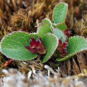 |
8. Past and future range shifts and loss of diversity in Dwarf Willow (Salix herbacea L.) inferred from genetics, fossils, and modelling Alsos I, Alm T, Normand S & Brochmann C Global Ecology & Biogeography, 18: 223-239 (2009) |
Read Abstract |
||
|
Aim Climate change may cause loss of genetic diversity. Here we explore how a multidisciplinary approach can be used to infer effects of past climate change on species distribution and genetic diversity and also to predict loss of diversity due to future climate change. We use the arctic-alpine plant Salix herbacea L. as a model.
Location Europe, Greenland and eastern North America.
Methods We analysed 399 samples from 41 populations for amplified fragment length polymorphism (AFLP) to identify current patterns of genetic structure and diversity and likely historical dispersal routes. Macrofossil records were compiled to infer past distribution, and species distribution models were used to predict the Last Glacial Maximum (LGM) and future distribution of climatically suitable areas.
Results We found strong genetic differentiation between the populations from Europe/East Greenland and those from Canada/West Greenland, indicating a split probably predating the LGM. Much less differentiation was observed among the four genetic groups identified in Europe, and diversity was high in the Scandinavian as well as in southern alpine populations. Continuous distribution in Central Europe during the last glaciation was inferred based on the fossil records and distribution modelling. A 46–57% reduction in suitable areas was predicted in 2080 compared to present. However, mainly southern alpine populations may go extinct, causing a loss of about 5% of the genetic diversity in the species.
Main conclusions From a continuous range in Central Europe during the last glaciation, northward colonization probably occurred as a broad front maintaining diversity as the climate warmed. This explains why potential extinction of southern populations by 2080 will cause a comparatively low loss of the genetic diversity in S. herbacea . For other species with different glacial histories, however, the expected climate-change induced regional extinction may cause a more severe loss of genetic diversity. We conclude that our multidisciplinary approach may be a useful tool for assessing impact of climate change on loss of genetic diversity.
Amphi-Atlantic • Arctic-alpine • Climate change • Colonization • Conservation genetics • Glacial refugia • Ice age • Phylogeography • Range shifts
|
||||
 |
7. Glacial refugia of temperate trees in Europe: insights from species distribution modelling Svenning J-C, Normand S & Kageyama M Journal of Ecology (Editor's Choice), 96: 1117–1127 (2008) |
Read Abstract |
||
|
1. The Pleistocene is an important period for assessing the impact of climate change on biodiversity. During the Last Glacial Maximum (LGM; 21 000 years ago), large glaciers and permafrost reached far south in Europe. Trees are traditionally thought to have survived only in scattered Mediterranean refugia (southern refugia hypothesis), but a recent proposal suggests that trees may have been much more widely and northerly distributed (northern refugia hypothesis).
2. In this study, the southern vs. northern refugia hypotheses were investigated by estimating the potential LGM distributions of 7 boreal and 15 nemoral widespread European tree species using species distribution modelling. The models were calibrated using data for modern species distributions and climate and projected onto two LGM climate simulations for Europe. Five modelling variants were implemented.
3. Models with moderate to good predictive ability for current species range limits and species richness patterns were developed.
4. Broadly consistent results were obtained irrespective of the climate simulation and modelling variant used. Our results indicate that LGM climatic conditions suitable for boreal species existed across Central and Eastern Europe and into the Russian Plain. In contrast, suitable climatic conditions for nemoral tree species were largely restricted to the Mediterranean and Black Sea regions. Large proportions of these northern and southern regions would have been suitable for a number of boreal or boreal plus nemoral tree species, respectively.
5. These findings are consistent with recent palaeoecological and phylogeographic data regarding LGM distributions of trees and other boreal and nemoral taxa.
6. Synthesis. It is clear that the view of the LGM landscape in Europe as largely treeless, especially north of the Alps, needs to be revised. Trees were probably much more widespread during the LGM than hitherto thought, although patchily distributed at low densities due to low atmospheric CO2 concentrations and high wind-speeds. The findings presented here help explain the occurrence of mammal assemblages with mixtures of forest, tundra and steppe species at many localities in southern Central and Eastern Europe during the LGM, as well as the phylogeographic evidence for the extra-Mediterranean persistence of many boreal species.
Climate change • Cryptic refugia • Hind-casting • Ice age refugia • Last Glacial Maximum • Maximum entropy species distribution modelling • Pleistocene • Pleniglacial vegetation • Range dynamics • Tree species distributions
|
||||
 |
6. Landscape genetics, historical isolation and cross-Andean gene flow in the wax palm, Ceroxylon echinulatum (Arecaceae) Trénel P, Hansen MM, Normand S & Borchsenius F Molecular Ecology, 17: 3528-3540 (2008) |
Read Abstract |
||
|
Knowledge of the role of landscapes in shaping genetic connectivity and divergence is essential for understanding patterns of biogeography and diversity. This is particularly relevant for the Andes region, a major biodiversity hotspot of relatively recent origin. We examined the phylogeography and landscape genetics of the Andean wax palm Ceroxylon echinulatum (Arecaceae) that occurs in two narrow bands of montane forests on each side of the Andes in Ecuador and northeastern Peru. First, we tested the hypothesis of C. echinulatum being a geographic cline species crossing the Andes in the Amotape–Huancabamba zone (AHZ) of southern Ecuador/northern Peru, as indicated by observations on fruit morphology. Second, we assessed the timeframe of cross-Andean divergence, and third, we investigated the impact of contemporary and historical landscape features on observed spatio-genetic patterns. Individual-based Bayesian clustering (BC) identified a northeastern, southeastern, southwestern, and northwestern cluster, with areas of genetic discontinuity coinciding with the Andes and the Giron–Paute deflection. F-statistics derived from BC suggested an east-to-west dispersal history. Population-based analyses revealed strong genetic structuring at both small and large geographic scales. Interpopulation relationships and Mantel tests strongly supported the cline model with cross-Andean dispersal in the AHZ. Along the cline, gene flow measured as FST was mainly limited by distance, with less but significant impact of climatic friction. Coalescent analysis revealed that cross-Andean divergence took place during the Quaternary. Significant historical isolation (RST > FST) was found in the southwestern population. The current study illustrates a joint effect of founder dynamics, divergence by distance and historical isolation on patterns of Andean diversity and distribution.
Amotape-Huancabamba zone • Andean phylogeography • Clinal isolation • Landscape genetics • Palmae • Vicariance |
||||
 |
5. Postglacial dispersal limitation of widespread forest plant species in nemoral Europe Svenning J-C, Normand S & Skov F Ecography, 31: 316-326 (2008) |
Read Abstract |
||
|
Climate is often singled out as the primary range limiting factor at large scales, while other environmental factors, notably soil, are thought to predominate at smaller scales. However, the postglacial migrational lag hypothesis controversially suggests that many species are strongly dispersal-limited and still expanding from their ice age refugia. We investigated the importance of postglacial migrational lag, climate, and soil as range determinants for 47 widespread forest plant species across nemoral Europe (47.0–60.0°N, west of 24.0°E) using regression modeling, information-theoretic model selection, multi-model inference, and variation partitioning. Migrational lag was represented by a measure of accessibility to recolonization from ice age refugia. Twelve species were largely ubiquitous and not analyzed further. For the remaining species, there was strong support for climate, soil, and accessibility to postglacial recolonization. Accessibility accounted for a small to moderate amount of variation, but its model-averaged regression coefficient was stronger than those for climate or soil for 11 species and the second or third strongest coefficient for an additional 10 species. The resulting odds ratios were greater than one for 33 out of 35 species, i.e. adjusted for climate and soil, prevalence for the far majority of the 35 non-ubiquitous species increased with increasing accessibility. There were no differences among growth forms in the importance of accessibility. In contrast, compared to non-boreal species, accessibility had little importance for species with wide boreal distributions, as expected from their more widespread, northern glacial distributions. In conclusion, even the ranges of many widespread forest plant species are probably still moderately to strongly limited by postglacial migrational lag. Therefore, although species ranges are also strongly influenced by climate, we cannot expect most forest plant species to closely track the expected 21st century climatic changes.
|
||||
 |
4. National and European perspectives on climate change sensitivity of the Habitats Directive characteristic plant species Normand S, Svenning JC & Skov F Journal for Nature Conservation, 15: 41-53 (2007) |
Read Abstract |
||
|
The main goal of the Habitats Directive, a key document for European conservation, is to maintain a ‘favourable’ conservation status of selected species and habitats. In the face of near-future climatic change this goal may become difficult to achieve. Here, we evaluate the sensitivity to climate change of 84 plant species that characterise the Danish habitat types included in the Habitats Directive. A fuzzy bioclimatic envelope model, linking European and Northwest African species’ distribution data with climate, was used to predict climatically suitable areas for these species in year 2100 under two-climate change scenarios. Climate sensitivity was evaluated at both Danish and European scales to provide an explicit European perspective on the impacts predicted for Denmark. In all 69–99% of the species were predicted to become negatively affected by climate change at either scale. Application of international Red List criteria showed that 43–55% and 17–69% would become vulnerable in Denmark and Europe, respectively. Northwest African atlas data were used to improve the ecological accuracy of the future predictions. For comparison, using only European data added 0–7% to these numbers. No species were predicted to become extinct in Europe, but 4–7% could be lost from Denmark. Some species were predicted to become positively affected in Denmark, but negatively affected in Europe. In addition to nationally endangered species, this group would be an important focus for a Danish conservation strategy. A geographically differentiated Danish conservation strategy is suggested as the eastern part of Denmark was predicted to be more negatively affected than the western part. No differences in the sensitivity of the Habitats Directive habitats were found. We conclude that the conservation strategy of the Habitats Directive needs to integrate the expected shifts in species’ distributions due to climate change.
bioclimatic envelope modelling • conservation • global warming • vegetation impact |
||||
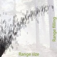 |
3. Range filling in European trees Svenning JC, Normand S & Skov F Journal of Biogeography, 33: 2018-2021 (2006) |
Read Abstract |
||
|
A response to Welk, E. & Bruelheide, H. (2006) There may be bias in R/P ratios (realized vs. potential range) calculated for European tree species - an illustrated comment on SVENNING & SKOV. Journal of Biogeography, 33, 2013-2018.
In their comment, Welk & Bruelheide (2006; hereafter, W&B) argue that the results of Svenning & Skov (2004; hereafter, S&S) are too influenced by confounding factors and biases to support our conclusion that the low R/P ratios found for many European tree species to a large extent reflect dispersal limitation. Although we agree that the estimation of potential species ranges is a topic that needs much further study, we believe the S&S results are at least qualitatively robust, and explain why below. Our response follows the structure of W&B's commentary. |
||||
 |
2. Geographical and environmental controls of palm beta diversity in paleo-riverine terrace forests in Amazonian Peru Normand S, Vormisto J, Svenning JC, Grandez C & Balslev H Plant Ecology, 186: 161-176 (2006) |
Read Abstract |
||
|
The palm (Arecaceae) community on low paleo-riverine terraces (terrace forest) in the north-western
dispersal limitation • distance decay • regional factors • scale dependency |
||||
 |
1. Spatial distribution and environmental preferences of the piassaba palm Aphandra natalia (Arecaceae) along the Pastaza and Urituyacu rivers in Peru Boll T, Svenning JC, Vormisto J, Normand S, Grandez C & Balslev H Forest Ecology and Management, 213: 175-183 (2005) |
Read Abstract |
||
|
Aphandra natalia (Balslev and Henderson) Barfod, an economically important fibre producing palm, is common in rainforest on low terraces along the Pastaza and Urituyacu rivers in Amazonian Peru. The aim of this study was to investigate the spatial distribution and environmental preferences of Aphandra in old-growth terrace forest to which it is limited in this region.Densities of immature and mature individuals were 507 ± 212 (S.D.) ha-1 and 19 ± 8 ha-1, respectively, in 11 (5 x 500 m) transects placed in old growth terrace forest near four villages and 739 ± 188 ha-1 and 96 ± 49 ha-1, respectively, in six irregular transects placed in what the local villagers considered dense Aphandra stands. We examined environmental and spatial correlates of Aphandra occurrences using stepwise multiple autologistic regressions. Site, soil moisture, slope inclination, and topographic position influenced the spatial distribution of Aphandra. Furthermore, the distribution was strongly clumped, independently of environmental factors, with particularly the concentration of immature individuals around adults pointing to dispersal limitation as the likely causal mechanism.
dispersal limitation • ecological sustainability • extractivism • fibre plants • non-timber forest products • palms • recruitment • resource availability • tropical rainforest
|
||||
 |
14. From decrease to increase: Protected nature in Denmark in an international perspective / Fra tab til fremgang: Beskyttet natur i Danmark i et internationalt perspektiv Biodiversitetsrådet. 2022 Nov 29. ISBN 978-87-974319-0-0. Purchase a hardcopy (Danish). |
Read Abstract |
||
|
The Biodiversity Council's main messages
Biodiversitetsrådets hovedbudskaber
Keywords: Biodiversity • national and international strategy • legislation • EU biodiversity targets |
||||
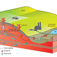 |
13. Landscapes with focus on climate neutrality and sustainability / Landskaber med focus på klimaneutralitet og bæredygtighed Dalgaard T, Normand S, Hasler B & Butterbach-Bahl K |
Read Abstract |
||
|
Agricultural landscapes include a large potential to support climate neutrality and sustainable development if accounted for the interconnection of the function and the resources landscape elements provide, which then can help significantly reduce greenhouse gas emissions. We give examples of how different dimensions of sustainability interact at the landscape scale.
|
||||
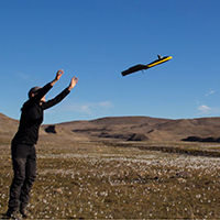 |
12. Vegetation dynamics in a changing Arctic / Vegetationsdynamik i et foranderligt Arktis Normand S |
Read Abstract |
||
|
We are living in a fast-changing world. Sometimes the vegetation is following these changes, sometimes not. Why? What processes are driving variation in vegetation dynamics? How do these changes influence the diversity and function of ecosystems? How can we study these changes by combining knowledge from cells to satellites?
Vi lever i en verden i hastig forandring. Vegetationen ændres nogle gange i takt med forandringerne, andre gange ikke. Hvorfor? Hvilke processer styrer variation i vegetations-dynamik? Hvordan påvirker ændringerne mangfoldigheden og funktionen af vores økosystemer? Hvordan kan vi studere ændringerne ved at kombinere viden fra celler til satellitter?
Keywords: arctic • climate change • shrub expansion • remote sensing • drone ecology • UAS • Greenland • The Young Academy |
||||
 |
11. Growth, function, and distribution of shrubs in the high Arctic Normand S & Treier UA |
Read Abstract |
||
|
How do arctic shrubs respond to climate change? Answering this question is essential for understanding how the function of Arctic eco-systems might change in the future.
Keywords: arctic • climate change • shrub expansion • drone ecology • UAS • Greenland • Villum Research Station Nord |
||||
 |
10. Arctic tundra in change / Arktisk tundra under forandring Normand S |
Read Abstract |
||
|
The Arctic is warming and the vegetation is changing. Shrubs are growing taller and increase in cover across the landscape, however, with various rates of change across the Arctic. We miss knowledge of the underlying processes. With the help of new research methods, e.g., drones and advanced models, the project is expected to gain insight on how the distribution of arctic plant species will change locally as well as biome-wide, as well as on the factors that drive these changes now and in the future.
Arktis opvarmes, og vegetationen er under forandring. Buske vokser sig højere og spreder sig i landskabet, men med forskellig hastighed på tværs af Arktis. Vi mangler viden om den proces. Ved hjælp af nye forskningsmetoder, fx droner og avancerede modeller, forventes projektet at bidrage med ny viden om, hvordan fordelingen af arktiske plantearter ændres lokalt og globalt, samt hvilke faktorer der driver ændringerne både nu og i fremtiden.
Keywords: arctic • climate change • shrub expansion • drone ecology • UAS • Greenland |
||||
 |
9. Arctic tundra in change / Die arktische Tundra wandelt sich Treier UA & Normand S |
Read Abstract |
||
|
Global change does not manifest itself everywhere to the same extend. In the arctic, temperatures rise faster than average which affects the occurrence and distribution of plants. Signe Normand and her team at Aarhus University, Denmark, aims at understanding the underlying processes.
Die globale Erwärmung manifestiert sich nicht überall gleich, in der Arktis wird es überdurchschnittlich wärmer. Das wirkt sich auf das Vorkommen und die Verbreitung der Pflanzen aus. Ein dänisches Forscherteam um Signe Normand von der Universität Aarhus untersucht die Zusammenhänge.
Keywords: arctic • climate change • shrub expansion • drone ecology • UAS • Greenland |
||||
 |
8. Greenlands Biodiversity – importance of climate in the past, at present and in the future / Grønlands biodiversitet – klimaets betydning i fortid, nutid og fremtid Normand S, Forchhammer MC, Høye TT, Jeppesen E & Svenning JC |
Read Abstract |
||
|
Grønland er temaet for Videnskabernes Selskabs festskrift til Dronningen i anledning af regeringsjubilæet. Det er kongehusets varme engagement i Grønland, der har været bestemmende for valget af tema. Medlemmer af Videnskabernes Selskab er blevet bedt om at give en alment forståelig fremstilling af et emne med relation til Grønland. Nogle har valgt at behandle et felt, der står centralt i deres daglige arbejde, andre er blevet udfordret til at tage nye emner op eller behandle dem ud fra en uvant synsvinkel. Det er blevet til 12 artikler fra en bred fagrække
Det er blevet til 12 artikler fra en bred fagrække: • Minik Rosing: »Grønland – en verden af mineraler« • Vagn Fabritius Buchwald: »Meteoritter og inuitter i Nordvestgrønland« • Hans Thybo: »Bjergkæder i Grønland – sammenhæng mellem topografiske og geologiske processer« • Dorthe Dahl-Jensen og Jørgen Peder Steffensen: »Indlandsisen på Grønland – et levende fjeld fortæller klimahistorie« • Knud J.V. Jespersen og Signe Lindskov Hansen: »Kongehuset og Grønland – i ord og billeder« • Torben M. Andersen: »Grønlands økonomi« • Reinhardt Møbjerg Kristensen: »Diskos dyr til vands og til lands« • Marita Akhøj Nielsen: »Glimt af Grønlandsforskningen – på opdagelse i Videnskabernes Selskabs skrifter« • Ellen Margrethe Basse: »Miljøretlige udfordringer i Grønland« • Kirsten Hastrup: »Det yderste Thule – fangerfolk og klimaforandringer i Nordvestgrønland«
På hvert deres felt formidler forskerne noget af den begejstring, der knytter sig til det videnskabelige arbejde, og tilsammen viser de, hvordan mangfoldigheden af perspektiver på et givet tema beriger dem alle. Dermed spejler de også Videnskabernes Selskabs virke. HM Dronningen fik festkriftet overrakt ved et symposium i Videnskabernes Selskabs gamle mødesal torsdag den 4. oktober. Se optagelserne fra Kirsten Hastrups velkomst her eller klik på de fremhævede forfattere ovenover, som holdt foredrag ved symposiet.
Keywords: arctic • climatic niche modelling • biodiversity • plants • animals |
||||
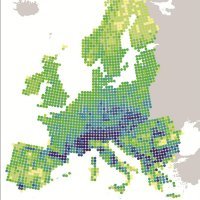 |
7. Distribution of the European Flora: current patterns with historical fingerprints / Fordelingen af Europas flora: nutidige mønstre med historiske fingeraftryk Normand S |
Read Abstract |
||
|
Kvartærtidens dramatiske klimaændringer har ændret planters geografiske fordeling gennem tiden. Det har efterladt varige fingeraftryk på europæiske plantearters nutidige udbredelser. Hvor, hvordan og i hvilken grad? Det belyser denne artikel. Keywords: Quaternary • climatic niche modelling • biodiversity • species richness • ice age |
||||
 |
6. A tool for management of nature in change / Værktøj til forvaltning af natur i forandring Fløjgaard C, Morueta-Holme N, Normand S, Svenning JC & Skov F KFT’s konferencemagasin (red. Lars Moseholm): 42-43 (in Danish, 2010) |
Read Abstract |
||
|
Forudsigelser af arternes respons på klimaændringerne er et vigtigt værktøj i planlægningen af en klimatilpasset naturforvaltning i Danmark.
|
||||
 |
5. Who comes, Who disappears?/ Hvad kommer, hvad forsvinder Morueta-Holme N, Normand S, Fløjgaard C, Skov F & Svenning JC KFT’s konferencemagasin (red. Lars Moseholm): 40-41 (in Danish, 2010) |
Read Abstract |
||
|
Klimaændringerne vil over de næste 100 år ændre levevilkårene for dyr og planter. Hvad kan vi gøre for at hindre negative og uønskede konsekvenser for naturen af et ændret klima? |
||||
 |
4. What happens with nature when climate changes? / Hvad sker der med naturen, når klimaet ændrer sig? Skov F, Svenning JC & Normand S Klimaændringerne: Menneskehedens hidtil største udfordring (ed. H. Meltofte): 75-85 (In Danish, 2008) |
Read Abstract |
||
|
Klimaet er bestemmende for udbredelsen af plantebælter på Jorden og har dermed stor indflydelse på biodiversiteten. Den globale opvarmning, vi står over for, er af en størrelsesorden, der ikke er set de sidste mange millioner år. Hvordan vil det påvirke biodiversiteten globalt, og hvad vil der ske med naturen og arterne i Danmark? |
||||
 |
3. Consequences of global warming for the Danish flora and vegetation / Konsekvenser af den globale opvarmning for den danske flora og vegetation Svenning JC, Normand S, & Skov F Flora & Fauna, 113: 11-120 (In Danish, 2007) |
Read Abstract |
||
|
Earth’s climate is changing, primarily due to anthropogenic greenhouse gas emissions. Past climate changes have had strong impacts of the flora of Europe, notably causing numerous extinctions at the onset of the Quaternary ice ages 2-3 million years ago. How will the current climate change affect the Danish flora and vegetation? We investigate this issue using bioclimatic species distribution modeling, assessing the potential impact of the climate change expected under the ICCP climate change scenarios B2 and A2 on the distribution of 104 selected plant species. The study species include 84 native species on the EU Habitats Directive list of habitat characteristic species as well as several sets of supplementary species. We find that under the A2 scenario climatic suitability will decrease for 83- 85% of the native characteristic species, which on average will loose 34- 42% of the current climatic suitability. Under the B2 scenario, suitability losses are smaller, but nevertheless 75-77% of the native characteristic species will experience decreased climatic suitability. The native Danish trees are predicted to be robust to the impending climate changes, while climate will become highly marginal to the introduced Picea abies. Many southern species, including evergreen tree species from Southern Europe and invasive species, should be able to thrive in Denmark under the expected future climates. To minimize the risk of potentially large plant diversity losses, priority should be given to minimize climate change and to mitigate the negative effects of climate change by ensuring the existence of large, well-connected natural areas as well as large, widely distributed populations, and, if necessary, direct translocation of species to areas with a suitable climate. |
||||
 |
2. Carex maritima rediscovered in Denmark / Krum Star genfundet i Danmark Normand S, Frederiksen RF, Wind P, Retsloff T Urt, 31: 68-71 (in Danish, 2007) |
Read Abstract |
||
|
Krum star (Carex maritima) er sidst observeret i Danmark i 1994. Vi genfandt den i en klitlavning ved Tversted Klitplantage i juni 2005.
|
||||
 |
1. Potential consequences of climate change on species distributions and biodiversity in Denmark / Sandsynlige konsekvenser af klimaændringer på artsudbredelser og biodiversitet i Danmark Skov F, Svenning JC & Normand S Miljøprojekt, 1120: ISBN 87-7052-248-0 (in Danish, 2006) |
Read Abstract |
||
|
I denne rapport analyseres de potentielle konsekvenser af de klimaændringer, der forudsiges frem til år 2100 ifølge klimascenarierne A2 og B2 fra FN's klimapanel (IPCC), for udbredelsen af 104 udvalgte arter af karplanter i Danmark. Resultaterne i denne rapport tyder på, at klimaændringerne over det 21. århundrede under både A2- og B2-scenarierne må forventes at have en overvejende negativ effekt på de undersøgte arter og sandsynligvis på den botaniske biodiversitet i Danmark som helhed. |
||||
|
My fascination for living organisms, especially plants, started in my early childhood when my grandfather introduced me to the wonders of nature. Numerous walks through forests, heath lands, meadows and salt marches with a magnifying glass and binoculars seeded my interest in understanding the factors setting limits to species’ growth at some places but not at others. Later I went to boarding school where the focus was on biology almost 24 hours a day, and then after high school I moved to Norway for one year where I attended a Folk High School specializing in outdoor life and sustainable use of nature. Finally, I studied Biology at Aarhus University, earning a Bachelor’s degree by studying what determines the distribution of Palms in the Amazon, and afterwards a Master’s and PhD degree by studying the distribution and diversity patterns of the European flora under the supervision of Jens-Christian Svenning. I love traveling and observing the difference in flora and fauna around the world. I have done fieldwork in the Amazon, Eastern Europe and Greenland, and had research stays in Switzerland (4 months, University of Lausanne, Antoine Guisan) and the United States (6 months, University of Missouri-St. Louis, Robert E. Ricklefs). Besides my studies I worked as assistant on botanical inventories and guided tours in the green houses of Aarhus Botanical Gardens. I have enjoyed my passion for vascular plants and bryophytes as a leader for botanical excursions to Corsica and Switzerland, as a board member of Denmark’s Bryological Society, and in both my teaching and personal life. After receiving my PhD degree I joined Niklaus E. Zimmermann’s lab for a Post Doc at the Swiss Federal Research Institute for Forest, Snow and Landscape. Since February 2014 I am back at Aarhus University.
|
|
|
View from one of our field sites in Greenland over the Nuuk Fjord. View to the right towards the sea and Nuuk, view to the left towards the inland and the ice sheet (July 2013).
Here you can check out some media outreach:
|
|

 At the edge: Corsican Pine